
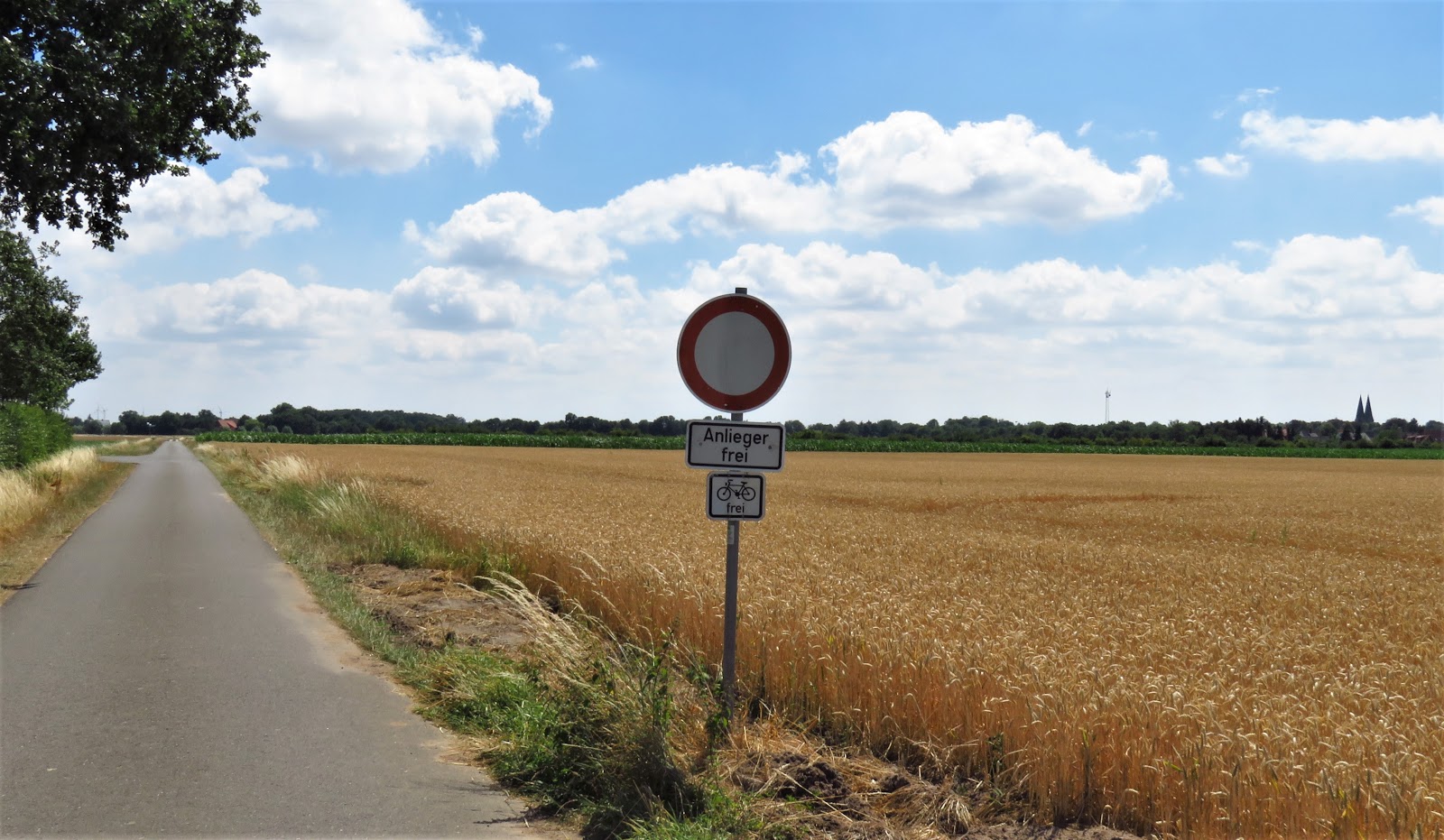
The Weserradweg (Weser River Cycle Route) never wandered far from the river, but only went directly alongside it (or over it on bridges) maybe 10% of the time, and within clear sight across fields another ~20% of the time. Although it carries some cargo and the occasional pleasure craft, it is almost entirely bucolic now that we're above the busy port of Bremen.


Perhaps there were other places we missed, but there was only one beach we noticed, in the town of Rinteln. Unlike the Rhine, which has been heavily altered -- some would say seriously injured -- by canals cutting through large bends in the river to shorten it, there were only two or three that we noted. Although these straight-as-an-arrow stretches might bring back memories of the Netherlands, these are actually far less interesting than free-flowing sections of the river.


There was one other change of note. For the first 2/3 of this leg, from Bremen to Minden, the land to either side of the river was scarcely higher than the river itself. This changed abruptly at Minden, as we'll explain in a moment, but for now do note that the hills add quite a bit more interest to the scene, yes? Note, too, that like all good German rivers, the Weser has signposts every kilometer telling boaters how many kilometers they are from the source or other fixed point upstream. In this case it is the junction of the Werra and Fulda Rivers, a point we will reach a few days beyond Hamelin.


 As you can see in the map of the Weser River watershed, there is a dramatic change in the landscape beginning just below the city of Minden. This is even more noticeable in the second map, a screen shot from Google Maps in terrain view mode.

 The canal is quite wide and able to accommodate large barges. None came by while we were there, so a boatload of tourists had to suffice to show the scale of the waterway. There are actually two canal aqueducts, side by side. The smaller one was built in 1915-16 and destroyed in WW II. Not by the Americans. Not by the Brits. Not by the Russians. By the German Army, as it retreated across Germany in 1945. It was rebuilt in 1949, but it proved too narrow for the larger and larger ships that started using the canal, especially after German reunification made the canal even more useful, and the new aqueduct opened in 1998. It now carries all the serious traffic, and lots of less serious traffic as well. That's the Weser down below, about 13 m / 40 ft. lower than the canal. Boats can of course connect up by a series of locks.

Looking south from the canal we could see that dramatic break in the landscape through the clutter of the city of Minden. It's called Porta Westfalica, the "Gates of Westphalia," the old name for the area just to the south. The tower to the left is the TV tower that serves the area and, so our tour book told us, also affords a grand view for those who wish to take the elevator to the top. The object puncturing the skyline to the right is the Kaiser Wilhelms Denkmal, a memorial to Emperor Wilhelm I built by the Westphalian government shortly after the Kaiser's death in 1888. This first "Kaiser Bill" is generally well regarded by history, especially for his success in 1871 of uniting a bunch of small duchies, principalities and kingdoms into what became known as the Empire of Germany. His son is not so well thought of these days, as he is widely blamed for causing WW I. In fact, the 25th anniversary of the memorial passed without a celebration of any kind since Kaiser Wilhelm II had recently abdicated in the wake of Germany's defeat in that war. The memorial is also famed for its views of the Weser valley, but we were not keen on biking the 170 vertical meters / 525 ft up to it, so we'll have to take our guidebook's word on that.

As recounted above, we were not always in view of the river. Occasionally that was because we were biking through some village or small city -- there were no large cities to be found here -- but mostly because we were in good farmland. It's been a very dry May, June and July hereabouts, and the crops looked better than perhaps they are in fact.


We started taking photos of a few of the more dominant crops. Corn and hay were pretty easy for us city slickers to identify.


 The landscape was mainly agricultural, with relatively little animal husbandry, but we did ride past the occasional small herd of cows or of sheep. In fact, Louise stopped and had a silent conversation with one curious little bundle of wool. We also had a good chance to see a family of cranes in the yard of a farmhouse we cycled past. The first photo shows one of the parents and one of its two offspring from this year. The parent then flew off and the wind picked up a little. One of the youngsters stood up and caught a gust of wind strong enough to lift him half a meter above the nest, too quickly for the camera to catch. We spent 15 minutes hoping for a repeat, and missed one or two other chances, but did catch first one and then both of the young storks "trying their wings." They need to learn fast, since storks usually leave Germany in mid- to late-August for the long flight to Africa, where they winter.


And while we're on the topic of these interesting birds, here are two "storks" we saw two weeks ago, the day we entered Germany.

And just as we were having all these stork sightings, our Seattle newspaper The Seattle Times ran two timely cartoons for us.


 On this leg of our journey we also began to focus a bit on the architecture. In Bremen we had seen examples of what has been called the Weser Renaissance style, a mix of German, Dutch and Flemish influences. The Bremen City Hall was a particularly fine example. Another was in a small city 25 km south of Bremen, Schloss Erbhof, built in 1620 for the elaborately outfitted aristocrat whose portrait still hangs there. They were getting ready for a wedding the next day but we were given a brief look at what had once been the palace ballroom upstairs. And check out the tile floor under Louise's feet!


In the town of Verden we had dinner al fresco, as we do several times a week whenever we are in Europe. Looking down on us was a modest Weser Renaissance city hall, attired in classical symmetry and an interesting gable front.

 One night we chose to ride 4 km away from the Weser to stay in Bad Oeynhausen. Mineral springs were discovered here in the 19th century and it was developed as a health destination. A large Kurpark was created with magnificent trees and flowers and places to enjoy the supposedly curative waters. These Victorian-era buildings were largely neo-classical, a rage at the time for structures that wanted to be taken seriously. The town has evolved in a curious way. There is still a large facility for "taking the waters," but it's called BaliTherme and the theme is exotic Indonesia, not the cure of a long list of diseases and disorders. However, a large number of medical clinics have set up shop in town and they do indeed address any number of medical issues, but from traditional medical perspectives. Some of the large buildings in the Kurpark are thus now medical clinics, while the largest one is now home to a theater company. Nearby are many comfortable hotels, including the charming one we stayed at with its colorful white and red theme, Hotel Wittekind.


At the south end of the Kurpark someone drilled down 720 m / almost half a mile in 1926 and created the Jordansprudel, now the world's largest carbonated, salty hot spring. Not overly hot, about 36 C / 96 F. Plenty salty, about 2.5% (seawater averages 3.5% though it does vary a bit). Don't know if anyone used to drink this stuff or still does, but warm salty mineral water? Not our cup of tea, so to speak. The Jordansprudel used to shoot up to 42 m, about the height of a 13-story building, but nowadays it's only usually good for half that. And only for 5 minutes out of every hour, when the valves are wide open. Then about 10 meters in between times, which appears to be what we're seeing in this photo, and nothing at night or at anytime in the winter. The authorities apparently hope to make it last longer if they space it out. Still pretty impressive considering no pumps are involved, the water is just squirting up on its own. The water by the way goes over to the BaliTherme. Presumably for bathing, not drinking.

 Getting back to architecture, we stopped at two other major sights. One was Stift Fishbeck, a cloistered convent that was founded over 1,000 years ago. The church was built in the 12th and 13th centuries. Its hushed stillness breathed centuries of history. In its dim corners one could perceive with only a little imagination some of the thousands of women who have worshiped within its walls, and see them with eyes uplifted to the dramatic crucifix high above them or ears turned to the massive organ at the rear of the church.


 A few kilometers before we reached Fishbeck, we had visited the other city of note, Rinteln. The city hall was built in the 1200s but "modernized" in the 1500s in Weser Renaissance style. A night watchman stands on guard nearby. Once a week, one of the locals gives a Night Watchman's Tour in the evening, but we were only there for a noontime stop so had to miss it.
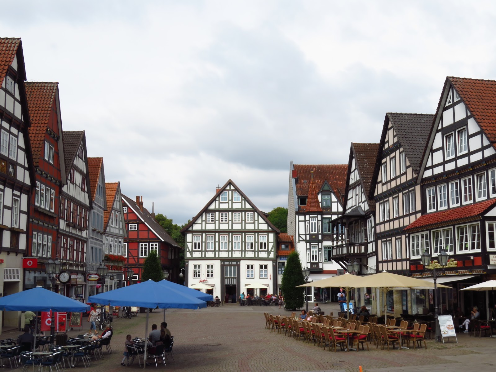
So far, almost all the buildings we've mentioned have been large structures. Rinteln gives us a chance to change focus to the architecture of everyday life. Rinteln had an amazing array of buildings that dated back to the 1500s and 1600s, still in use, still in good condition.


Starting soon after we left Bremen, we started encountering even more vernacular architecture, i.e. that style of building shaped not by architects seeking to make a statement but by ordinary folks seeking to meet local needs, using locally available resources, and following local traditions. This was particularly evident in the barns and other farm buildings we rode past. Or rather rode up to and stopped to admire and photograph. Here are a few, none of them listed as sights to be stopped at in our guidebooks.


In two small towns we encountered Scheunenviertel, which our guidebook did tell us to stop for. These are "barn districts" to which old barns have been moved for preservation. Many photos were taken. Here are a few.


In one barn you could see the marks made before the barn was disassembled, to be sure the wooden beams were put back in the correct order. In another, one section was left only partly plastered so visitors could see "underneath" the final finish.


This style of building with a mix of heavy timbers and of brick or plaster in between is known in English as "half-timbering" and in German as Fachwerk. We saw very little of it when we were in the area of the North Sea, since there were few large stands of trees available in older times for the timbering part of half-timbering. But now we saw more and more as we moved south and into the hills and woodlands beyond Porta Westfalica.


Which brings us to Hamelin. Most everyone knows the story of the Pied Piper of Hamelin. He appears in town on a certain day in the year 1284, says the legend. Says he's a ratcatcher. He'll get rid of every rat and mouse, for a certain price. He puts on a multicolored ("pied") shirt, pulls out a flute, and the rats and mice all follow him to the river and drown themselves. With no more rats or mice, the city fathers decide they don't need to pay the full price previously agreed upon. The ratcatcher leaves in a foul mood, but comes back some time later in disguise, and while all the adults and older children are in church. This time his flute attracts all the young children, and the last anyone sees of him or the kiddies, they're headed into a cave that reputedly takes them off to eastern Europe. Three children are left behind to tell of what happened -- a blind child who couldn't see where to go, a deaf child who couldn't hear the flute, and a crippled boy who couldn't keep up.
Hamelin could "sell" itself as a tourist destination just based on its charming Altstadt or old part of the city, filled as it is with fabulous Fachwerk. But it has gained far more fame and tourists by touting the rat theme. The first bridge we passed had a rat on top. Little white rats lead to the tourist info building. Shiny brass rats define a trail you can take to all the leading sights.


 In addition, the town puts on two shows a week in the town square, with no admission fee (though they do pass rat-shaped purses around for donations afterwards). The bigger one is on Sundays and we were not there on the weekend. But we did catch the Wednesday musical. Could barely understand a word that was sung, but there was no problem following the familiar story.


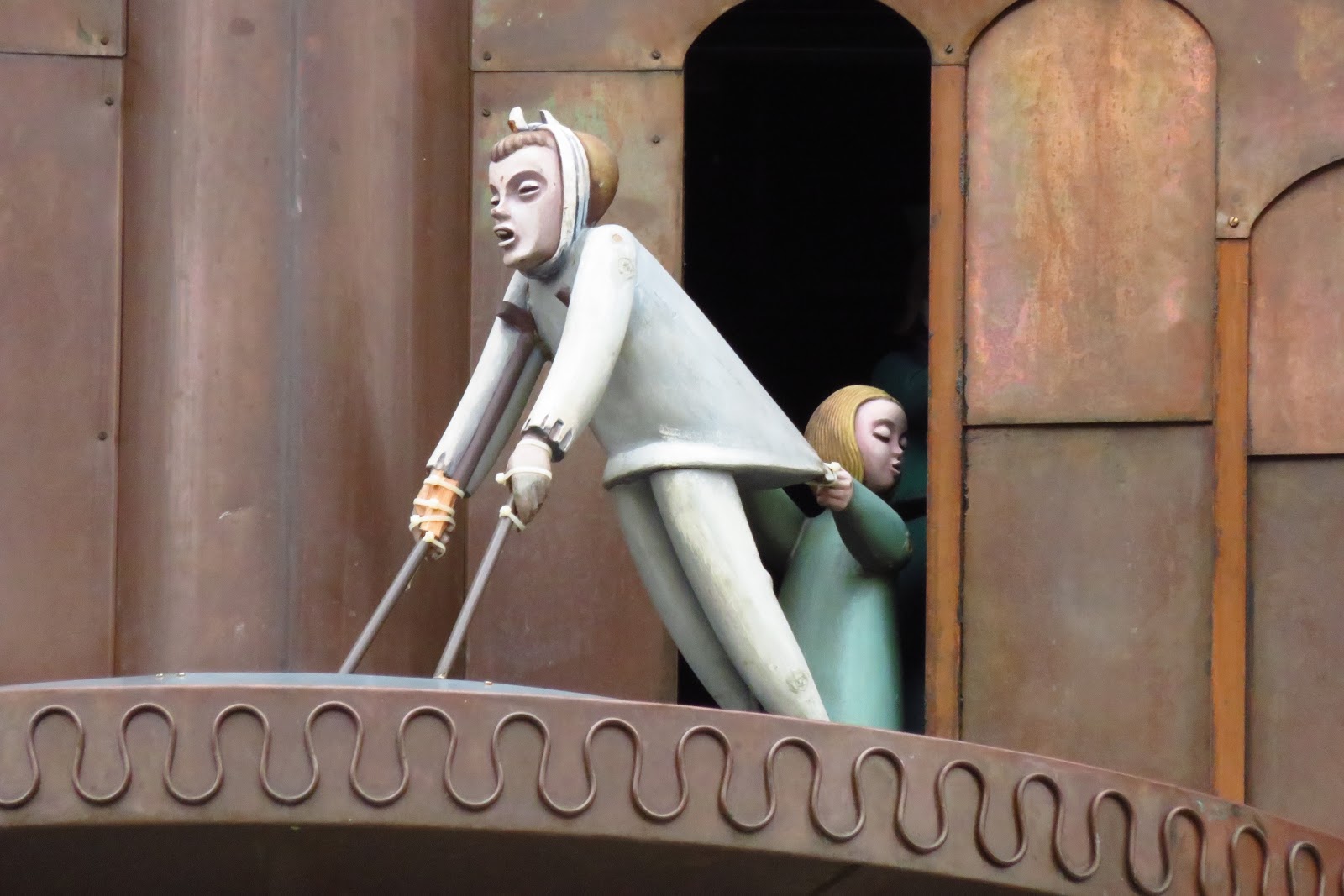
Then there's the mechanical clockworks that parade out three times a day to tell the story in tin figures just below the town Glockenspiel.


It's all enough to make you want to hug a rat!

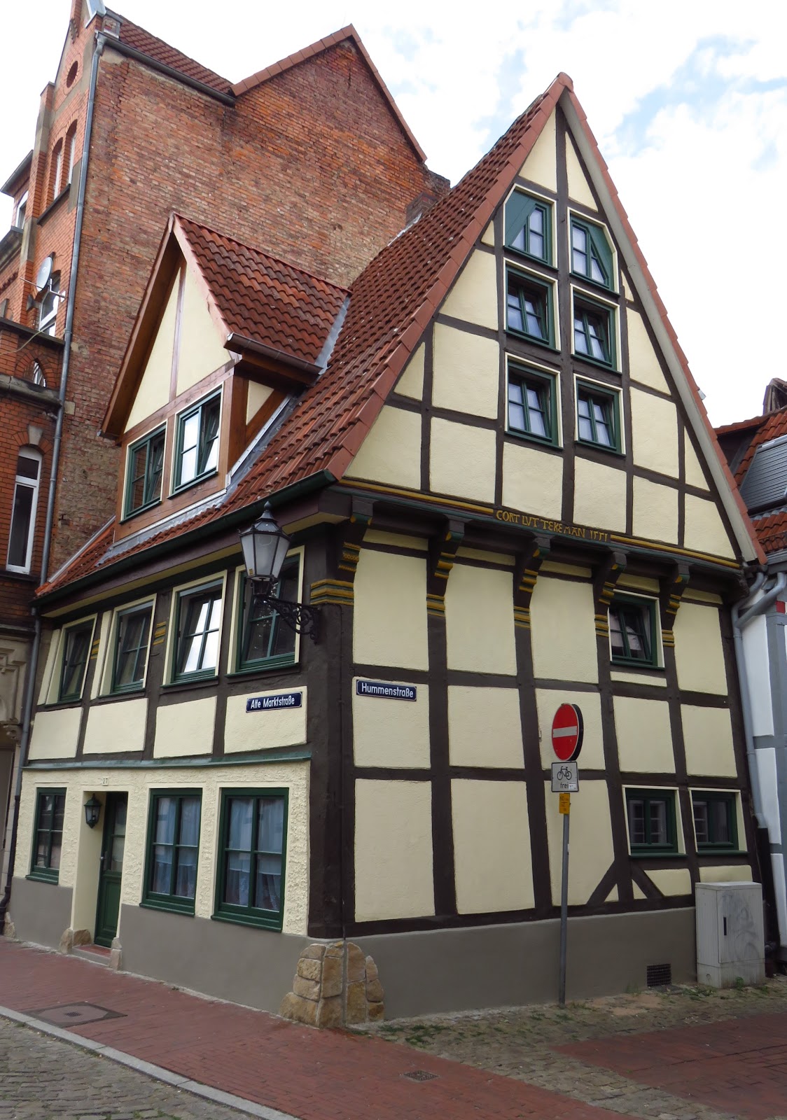
And the architecture we started to talk about? It's there, it's old, and it's wonderful.


In that last photo, the hotel with the red roof was our lodging for three nights, the Historik Hotel garni Christenhof, itself a fine Fachwerk structure. As nice as it was outside, the breakfasts inside were fabulous. Each morning we had individually prepared scrambled eggs with herbs and veggies, and the buffet table was filled with other wonders. Our biggest culinary challenge in eating our way across Europe is finding enough vegetables, and this was a cornucopia of gourmet delights, attractively presented and tasty as all get out.


On that tasty note, we bid adieu until our next blog, which will take us to the the confluence of the Werra and Fulda and thus the end of the Weser, then up and back on the Fulda and one of its tributaries, the Eder.

No comments:
Post a Comment