Wednesday, September 29, 2010

More Islands: Rhode, Block, Long and Shelter

OK, Rhode Island isn't really an island . . . but why exactly is it called Rhode Island?  We'll have to leave that for others to answer.  In any event, we headed there on fast ferry #5 from Martha's Vineyard, landing at Quonset Point, and biked about 25 miles along the RI coast to Point Judith.  A little lighthouse amused us en route to Quonset -- exactly which one of the dozens of bridge spans was it guarding?

On that route along the coast we visited Narragansett, at one time a major competitor with Newport for the spendy crowd.  The renowned architectural firm of McKim, Mead and White designed a grand casino for Narragansett in 1886 but alas a fire in 1900 burned most of the wooden casino, leaving only  the granite section that spanned the road along the coast.  We stopped by as we walked back to our B&B from supper and learned the history from two women who were chaperones for the local high school's senior class, which was having a dance in the grand ballroom upstairs.  And while we were taking the shot of the building and shore the next morning, a local fisherman provided a little interest to our right, though his catch turned out to be too small and was tossed back a few moments later.


Real fishermen call Point Judith home, and we saw dozens and dozens of fishing boats like these as we made our way through the port to the Block Island Ferry.  As we left port we could see Block Island in the distance -- it's that pencil smudge on the horizon above the right-hand breakwater.  This was our first single-hulled ferry, complete with a full load of cars and trucks, but Block Island Sound was calm and it was an easy crossing.  You'll notice the ferry coming the other way as we approached Block Island -- it has a pointed bow, as did ours.  All the cars and trucks have to be loaded by backing them in.  Though we didn't get to experience it, the weather can be pretty rough out there.  Puget Sound it's not.


We had a good location on the island, half a mile from town and overlooking two small freshwater ponds perched on a shelf just above the ocean.  We took a path down to the ponds and had a thirty-minute paddle in a kayak, time enough for two circuits of both ponds and a few pictures!  That's the Spring House Hotel just above us, a nice late-19th century seaside hotel that is doing well in the 21st century.  There was a time when it and many other large hotels on Block Island sat empty in the '70s through the 1990s, but they're "in" again and all seem to be holding their own, even given the fairly short season when tourists in any numbers show up on Block Island.

It's a small island, 30 square miles to Nantucket's 48, the same size as Vashon Island near Seattle.  But Nantucket has 10,000 year-round residents to Block Island's 1,000.  Even in summer there are many fewer folks "on the Block," as they put it locally, as its population generally only triples while Nantucket's quintuples.  Which is part of why it appealed to us more than Nantucket or Martha's Vineyard.  Let's show you a few places we liked.  First was Southeast Light, built in 1875 and moved, if you can imagine it, 360 feet back from the cliff that was disappearing beside it in 1993.  And it's a long way down.  Between the height of the land and of the lighthouse, the lens is 261' above water, and the light can be seen from far out at sea.  By the way, that's Montauk Point on Long Island in the distance, our next destination after our two nights on the Block.


Next to the lighthouse was this small radar station with a very unusual mission -- it's tracking birds!  A company called Deepwater Wind RI wants to build several wind turbines offshore, plus lay an underwater power transmission line to the mainland for days when the wind isn't blowing.  The radar is to see if it's feasible given the avian use of the area.  Many of the locals support the plan in the hopes that it will end Block Island's dubious distinction of having the highest electric rates in the country, since all power is currently generated by diesel that must be shipped in, with no connection to the New England power grid.

Once again we were charmed by stone walls along quiet country roads, all the more enjoyable without the heavy panniers on our bike.  We wore small backpacks to carry our walking shoes and locked up the bike near the North Light, seen here across Sachem Pond, and took the Clayhead Trail for some more dramatic cliff views where Block Island is slowly sliding back into the Atlantic.  One trail took us to the shore where we added our own rock tower to others we found there, and admired the surf hitting a small glacial erratic sitting on the beach.


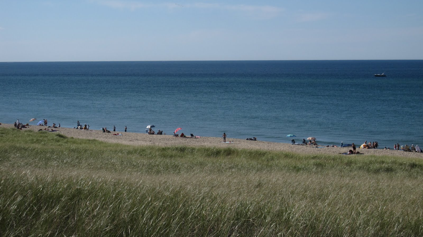
The trail took us two miles down the coast, then we walked back along yet another stone-wall-lined road, with two more side-trails showing us the other side of the island and this lonely beach house sitting at the edge of the dunes.


As noted above, we really enjoyed  Block Island, and would return here before Nantucket or Martha's Vineyard, even given how interesting those two islands are.  We enjoyed the slower pace and the relative lack of monied pretentiousness.  Oh, it's not cheap on the Block -- everything has to be shipped in, and it's a small captive market -- but it still had more of that getaway charm we found a little elusive on the first two islands.

Actually getting away, however, proved to be an issue.  A major storm was brewing to the southwest of us, and our passenger boat, seen the day before in calmer conditions, was single-hulled. Our route was only 10 or 20 degrees from being parallel to the wave troughs and those troughs were several feet deep, so the boat did a bit of pitching and a whole lot of rolling.  Thankfully lunch stayed down and we arrived in Montauk two hours before the rain, just enough time to get to the motel, get showered and changed and dressed in our rain gear, and into a nearby restaurant two blocks away.  This was the same storm that had just created two small tornados and a "mini-burst" in New York City two hours earlier, but when it hit us it was down to being a heavy downpour with crashing lightning, an exciting and somewhat intimidating spectacle from our corner seats in the restaurant.


Long Island is indeed long, about 118 miles, only 23 across at the widest.  With a population of 7.4 million (2 of its 4 counties are Brooklyn and Queens, parts of New York City), it has more people than many much larger islands, such as Ireland or Hokkaido.  It has a sort of fish shape with two tails at the eastern end, each actually the terminal moraine of one of the glacial advances 10-40,000 years ago.  The more southerly tail is Montauk, and the lighthouse there dates to 1796, the oldest in NY and the fourth-oldest active lighthouse in the country.  Jeff's brother used to drive the 100 miles here from his home in Queens to go birdwatching, since it does stick far out into the Atlantic and attracts birds that typically stay well out to sea.  But neither of us had been here before, so it was exciting to see it at last.  We then rode west 25 miles through a remarkably uncrowded, almost desolate area of sand dunes and salt marshes, into East Hampton.  That town did indeed live up to the reputation of The Hamptons.  We did not actually see too many fancy houses, not because they're not there, but rather because they have such immense grounds, thick hedges, large fences and walls or all of the above, that we could only catch momentary glimpses of a few of these Gatsbyesque getaways, and imagine how much bigger the remaining hidden ones were.

Our next night after Montauk was on Shelter Island, another place that Jeff had heard much about but never seen, as it was where his folks spent a brief honeymoon in 1942.  They certainly didn't spend it where we stayed.  It was one of the more disappointing B&Bs we've stayed at, aggravated considerably by having the least comfortable bed we've encountered out of the 60+ we've slept in so far this trip.  The owner did not fuss when we cancelled the planned second night, apparently aware that the bed in our room left too much to be desired.  We loaded up the bike and saw a few places we had planned to see with an unloaded bike, the most interesting of which was this beach where we watched a sailboat regatta in Gardiner's Bay, the water between those two fishtails of Long Island, Montauk Point (visible in the distance on the right) and Orient Point.


We then took one of these very small ferries off Shelter Island and out to Orient Point, past a snowy egret, a great blue heron and other shore birds, and caught the last of our ten ferries from Orient Point to New London.  Down below is a shot of a sister-ferry to the one we were on coming past some of the rocks that challenge navigation leaving Orient Point.


We'll close with a few shots of New London, starting with the entry to the harbor with the big I-95 bridge at the head of the harbor spanning the Thames River, and the cruise ship Crown Princess just leaving port after a morning's port call for passengers to visit nearby Mystic Seaport.  Ah, that brought back memories of those dozens of port calls we made in 2008 and 2009, described in older posts you may have read back then.


Then our ferry pulled into its slip next to downtown New London, a town with a remarkable number of interesting old buildings, including these four called "Whaleoil Row" that were built by whaling ship captains in the 1840s.


The next morning we rode a bike trail over the Thames on the interstate bridge to Groton CT, home of the USS Nautilus.  This was of course the world's first nuclear-powered sub -- in fact the first large-scale use of controlled nuclear power ever -- built nearby in 1954.  It was in active service until 1980, and since 1986 has been on display here.  Its most famous mission was in 1958 when it reached a spot logged as "90 degrees north latitude, longitude indeterminate" -- the North Pole.


It's open for self-guided walking, or should we say crawling and crunching, through the central part of the boat.  Here are views of the mess and of a bunkroom that slept 12.  The sweaters on our closet shelves have more room than these guys had!  And for storage, what you see is what you got.  Claustrophobes need not apply!


Well, we're back on the continent again after two weeks of island-hopping.  Next up are visits to several friends and family in Connecticut and New York.  We'll bring you the photos in our next entry.

Friday, September 24, 2010

Cape Cod, Nantucket and Martha's Vineyard

We left you in our last blog post about to land in Provincetown, at the far tip of Cape Cod.  The Cape and the islands of Nantucket and Martha's Vineyard are all products of the last continental glaciers that descended over New England and other northerly parts of the US.  In moving south through New England the glaciers scoured the rocky Appalachian Mountains, carrying off large amounts of it as boulders, rocks and sand.  When the glaciers stopped advancing they dropped their load like conveyor belts, and these sandy outposts resulted.  Accordingly, they have fairly similar fauna, flora and topography to each other.  Of course humans have introduced their own imprint on the land, and the islands, being islands, have developed somewhat differently than the mainland -- more about that further along.

One of the things that surprised us was the extent to which the Cape and the islands were forested, particularly with pines and oaks.  Here is a little piece of the forest ending just short of some sand dunes near Provincetown at Race Point.  That's the old Life Saving Station peeking up behind the dunes, a forerunner of the Coast Guard where men were stationed, ready to row out to sea in lifeboats when ships ran aground, which they did with some regularity given the tricky currents and shallow seas around the Cape.  Race Point itself has a nice beach, which these folks are enjoying on Labor Day before heading back to the workaday world.


Which brings up a point about our timing.  We had planned to do a trip like this two years ago, in reverse, as we headed north toward Canada -- but in July.  No could do.  The prices for lodging were outrageous.  But Labor Day is really a great divide, and the Provincetown room we rented for $79 on Labor Day evening was $159 the previous night, and perhaps for the previous 90+ nights since Memorial Day.  Nantucket and Martha's Vineyard were not cheap even after Labor Day, but not high enough to make us gasp for air.  We grimaced a bit, but argued to ourselves that we'll probably only do this once, so what the heck . . . !  In fact, the ferries stay the same price throughout the season, and it's not a cheap price.  The ten ferries we took over the next 14 days added up to $510 for the two of us and our tandem.  But that "well, just this once" argument won this mental battle as well.


As we worked our way south along the Cape we stopped at a beautiful spot where the National Park Service has set up a visitor center, Salt Pond.  New England generally and the Cape and islands especially are full of "kettle ponds," roughly circular bodies of water formed when a chunk of the receding glacier made a deep imprint in the land that gradually became a pond as it melted.  Some of the shallower ones filled with decaying organic material and became bogs that made the Cape famous for cranberries.  This one happened to be so close to the ocean that a large wave finally breached it and it became a sort of tidal lagoon.  We hiked partway around it and also to a nearby bog to get a feel for the land.  A two-mile bike path starts at the visitor center and took us on our tandem to an even larger salt marsh just behind a barrier beach just out of view to the left.


We spent a second night on the Cape at Chatam, the bend in the elbow of the Cape, then on to Hyannis.  The older of our readers will recognize this as the location of the famous Kennedy Family Compound.  Others of our readers will probably react more to the news that Hyannis is now home to a Trader Joe's, the first one we've encountered since leaving Seattle 3 months ago.  Needless to say, we dropped a few dollars there as well as on the ferries and at the motels.  In any event, at Hyannis we picked up the third of our ferries, yet another fast catamaran, the MV Iyanough.  The ferry pulls into Nantucket Town, the largest community on the island and the only port.  You can see the port behind the white railing leading to the lighthouse that marks the entrance to the port, which we visited by bike the next day.

Nantucket is a very interesting place.  It's exceedingly scenic, exceedingly historic, exceedingly rich.  We were astonished at the number of jewelry stores in Nantucket Town, and we're not talking costume jewelry or strings of sea shells.  We found it pretty much impossible to find a restaurant meal that wouldn't hit $50 for the two of us, with no extras like appys, drinks or dessert.  But gosh, the streets are lined with homes ranging from cute to just downright gorgeous in their simplicity!  Here are some shots on two of the side streets:


Then there's the old windmill (the rest of the wooden support for the sails was taken down a few days earlier when Hurricane Earl was about to swing past the island, where the winds did top 40 mph), and the oldest house on Nantucket, the Jethro Coffin House built in 1686.

We found a great location for our two-night stay, the Hawthorn House, built in 1849.  Around the corner were flower-garlanded shops by day, transformed into attractive streets to stroll down and window-shop after dinner at night.


As you can see in the last picture above, part of Nantucket Town is cobbled.  We didn't even think of biking on these things --we'll leave that to crazy European bike racers, who do it routinely in their spring rides -- but couldn't help but notice how interesting the streets seemed to become when they were cobbled.  Here are several of our favorite shots:

If there's one thing even more extravagant than taking the ferry to Nantucket, it's taking a ferry there with a car.  Makes Washington's car ferries seem like a bargain.  Not to mention the fact that you sometimes have to book a few months in advance to get the date and time you want!  But with our bike, we had mobility, and we took advantage of it.  Nantucket's not a large island -- although it's almost exactly twice the square mileage of Manhattan Island, it's only about 90% as large as San Juan Island or Orcas Island in NW Washington -- and getting around by bike is easy as they've built nice bike trails parallel to almost all the main roads leading out of Nantucket Town, which is right in the center of the island.  We explored the beach at Madaket at the western edge, but absolutely adored the cute homes in Siasconset, called 'Sconset by the locals, at the eastern edge of the island.  They are deceptively old, given how well-kept they appear, most dating from the 1700s and early 1800's. 


Two final things are worth mentioning about Nantucket.  The entire island is an historic district, meaning that every building put up on Nantucket must be approved by a committee.  You don't see modern architecture on Nantucket, but then you don't see ugly buildings either.  Yes, there is a remarkable homogeneity that does not necessarily appeal to everyone, but the folks who control things there appear to like it very much. 

The other thing has to do with the look of everything else that's not man-made, i.e. nature itself.  There's quite a bit of it.  Of course islands always have their vistas of the ocean, but Nantucket also has a lot of vistas of greenery as well, thanks to several organizations.  Two that stand out are the Nantucket Conservation Foundation and the Nantucket Island Land Bank.  The former controls over 25% of the land on the island, the latter almost 10% and growing.  The Conservation Foundation consists of land donated by individuals or purchased by donations.  The Land Bank was created by the voters, and is financed by a 2% fee added to most real estate transactions.  With other smaller organizations and government agencies also protecting land, almost 50% of the island is protected forever from development.  It's a remarkable accomplishment for a place as desireable as Nantucket!  You can see some of this open land beyond the golf course at 'Sconset in the photo below, and we've attached a map to the right that shows in more detail what's protected as of earlier this year -- everything in light or dark blue (foundations) or in dark brown (government).  So take your time getting here, it's not going to change much between now and when you arrive!


We saw a lot in our 48 hours on Nantucket, including one last view of it as we left on our way to Martha's Vineyard, our next stop.  Obviously, this is a part of the island that the conservancy people are not likely to be looking at any time soon . . .
Martha's Vineyard has many similarities to Nantucket but important differences.  It's almost twice the size as Nantucket and at 7 miles from Cape Cod, is well within sight compared to its neighbor, which cannot be seen from the mainland.  It's large enough to have a number of communities, each with distinct characters.  What we noticed more on the Vineyard than on the Cape or on Nantucket (though they were present there in less noticeable manifestations) were the stone walls.  New England is famous for them, attractive as well as an effective way for farmers to clear their land of all those rocks the glaciers brought down, and have an inexpensive wall to boot!  The most impressive ones of course are those that use no mortar, and we passed some great ones.  Now the glacier occasionally brought some really large rocks --  no problem, just incorporate them into the wall!


With three nights to explore the Vineyard, we got out to quite a bit of the island down those charming narrow roads.  It looks pretty daunting, but the drivers were very courteous, and we never felt endangered riding roads like these -- cars just waited to pass, and gave us lots of room.


Once again we hit the westernmost and easternmost points, Gay Head and Edgartown.  The town of Gay Head, named after this "gaily colored" cliff, officially changed its name to Aquinnah in 1998.  Whether that was politically expedient or politically incorrect, we'll leave for others to decide.  Edgartown was the most attractive town on the Vineyard in many ways, but after having taken photos of so much of Nantucket, which is more attractive still, the only thing that got us to pull out the camera was this serene lighthouse just north of town, guarding the waterway that separates Edgartown from Chappaquiddick Island in the distance.

Well, no trip to Martha's Vineyard is complete without some time spent wandering through Oak Bluffs.  In the 1830s, a time of great religious enthusiasm sometimes called the Great Awakening, evangelical ministers started conducting camp meetings here.  These became increasingly popular, attracting thousands by the 1860s.  Some folks had been storing tents here from year to year, and in the 1860s many of those folks started putting up small cottages instead.  Today the Oak Bluffs Campground Association contains hundreds of these small charmers, full of color and detail.  We spent a delightful hour wandering around slack-jawed at all the architectural pastries around us.  Ooooh, look at that one!  Hey, check out the gingerbread molding on this other one!
The campground area became so popular, other developers started building nearby on larger lots.  Here are a few in that area that caught our eye:

Well, after 7 nights on the Cape, Nantucket and Martha's Vineyard, it was time to move on.  We'll tell you about the next 6 ferries and the rest of our island adventures on Block Island, the eastern end of Long Island and on tiny Shelter Island in our next post.