

The walk began on September 8, and the date on today's blog post shows just how challenging it is to wrap up these blogs, once your trip is over and you're again in your cozy, comfy but oh so busy life back home. [stage direction to reader: give a knowing smile]
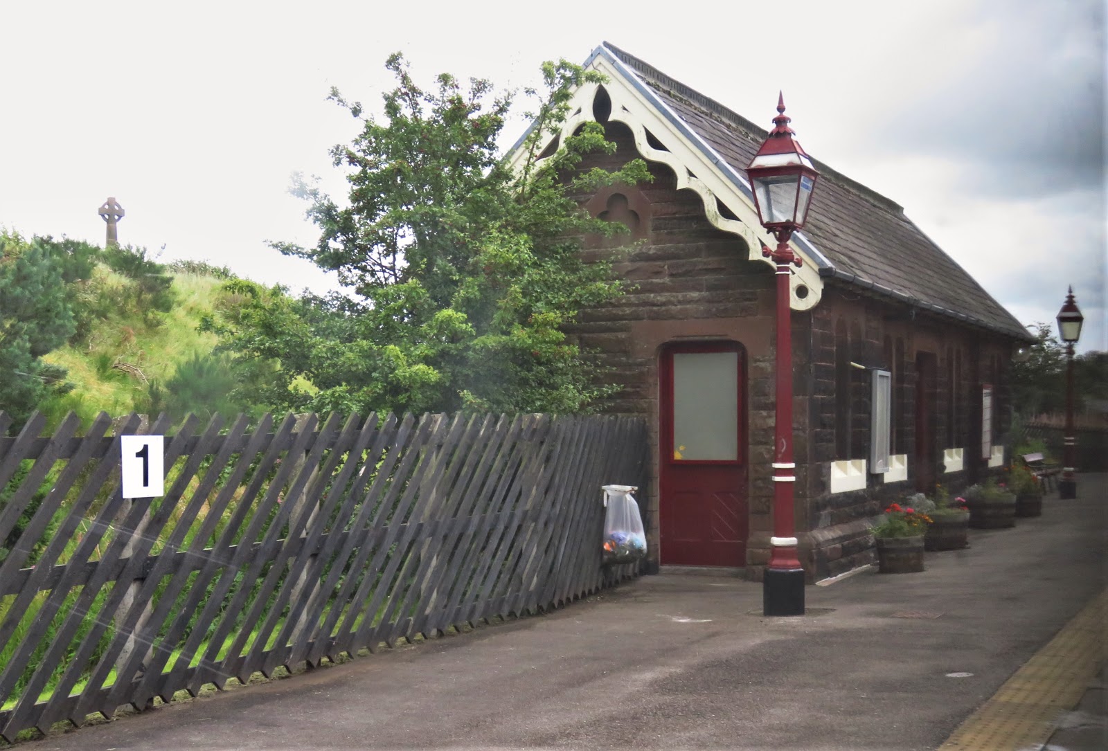
Our journey begins with a ride on the Carlisle and Settle Railway, which many consider the most scenic line in the UK. Since we haven't explored too many rail lines, that's a claim we cannot vouch for, other than to say it was splendidly picturesque and a good whetting of the appetite for part two of the adventure, hiking back through the area on the Dales Way. The train is shown in blue, actually going 110 miles from Carlisle through Settle to Leeds. The hike goes 82 miles from Ilkley to Bowness-on-Windermere, and is shown in red.


As we started out, the topography was gently rolling and fairly verdant. This soon changed as we climbed higher into the Yorkshire Dales. At Aisgill Summit we were at 1,169 feet above sea level, the highest point on the line. Please excuse some blurring of the foreground as the shots were taken from our train window, generally as we moved along at up to 50 or 60 mph.


We were particularly excited to see the area where our walking route would cross under the rail route. The scenery was indeed more rugged in this area. The second shot below was taken as we crossed over the 117 foot (36 m) high Arten Gill Viaduct. Following it are photos we took a few days later, when we approached it on foot and then stood beneath this graceful behemoth.


The rail line went over two more impressive viaducts, including the famous Ribblehead Viaduct, almost as tall as Arten Gill but much longer at 440 yards (400 m). Below us were hikers enjoying a pleasant walk through the moors. Unfortunately, the day we needed to be hiking this segment, the weather did not cooperate, and we ended up skipping it, as we'll get to later in today's blog.


As we also quickly learned, we would be sharing the Dales Way with thousands of sheep, with a few thousand cows later joining another several thousand sheep.


A mile or two in, a rainbow appeared. In this case it was not a good sign. Our rain gear appeared on us soon after. It went on and came off five times that day, as showers moved through. The trails by no means became impassable, but we did become well acquainted with mud. Since the rain returned every day for the first 7 of our 9 hiking days, we became very well acquainted indeed, as some later photos will sadly demonstrate.


Our first point of interest was St. Peter's Church in Addingham. It looks like many others all over England, but it has the distinction of showing off an Anglo-Saxon stone cross discovered in a field next to the church, showing that Christian worship has occurred here for over a thousand years.

We were down in a valley, following the River Wharfe. High above us were the moors, painted lavender by the late-blooming heather. Then, peeking through a riverside copse, we spotted the ethereal remains of Bolton Abbey. Part of the abbey was not torn down in the 1530s when King Henry VIII ordered all the convents and abbeys of England destroyed, and that portion continues to be used as a parish church. But littered around the churchyard like graves are the remains of the remainder of that once-grand place, which signs re-created for us. It was hard to leave this historic spot, but a look back on the way north helped ease the parting with its beauty.


Next up was a spot called The Strid, apparently derived from the verb "stride." However, striding is precisely what folks are called on NOT to do. Although the Wharfe narrows down to the point it appears one could stride across, the list is long of persons who have tried and failed -- and drowned. Underneath the rocks are caverns where undertows convey and consume their victims. We stayed put on our side.

If this valley seems picturesque to you, you're not the first. The renowned artist J.M.W. Turner came here multiple times. A signpost alerted us to a spot near which he painted the ruins of 15th century Barden Tower. Not quite identical to our perspective, so either our spot was not "spot on," or he employed a bit of artistic license, or both. With our telephoto lens we got a closer look at the tower, or what remains of it.


And that was just the first day. We won't cover the rest in quite that detail, but there were exciting new vistas and discoveries each day.
As this is our first foray into long-distance hiking in England, we signed up with a company that made all our lodging bookings and arranged with a service that picked up our one suitcase each day and carried it on to the next pub or B&B. Since lodgings did not always appear, or come available, at the distances we wished to do each day to even out the miles, they also arranged a few taxi rides for us. Day two was such a day, and so we found ourselves transported that morning to the hamlet of Appletreewick and its classic British pub, The Craven Arms. As our taxi driver put it, the views that morning were ones we might see again on the covers of biscuit tins and boxes of chocolates, they are so charming.


 The pub is named after Sir William Craven, who was born here and went off to London to make his fortune. And that he did, as a merchant tailor. He then turned to politics and became Sheriff of London in 1601 and Lord Mayor in 1610. In 1602 he paid for the construction of a grammar school in nearby Burnsall, and later for the bridge seen below that connects Appletreewick and Burnsall. Both structures are still standing and doing good service. Indeed, the school is said to be the oldest in England to be still operating in its original building.


The next day promised more rain showers and wind, and was scheduled to be 12 miles long. We had discovered that the supposed distances in our guidebook understated what our pedometers were telling us, not to mention our bodies. Despite an easier second day, we were not ready for such a long one. And then there was the hill to consider. The route left the valley and ascended all the way to the moors. No doubt beautiful, but on a better day for weather and bodies better hardened to the challenge. And so we found ourselves back in the taxi, skipping that part of the hike. As it was we still hiked 10 miles, thanks in part to a pond that had formed on the trail, forcing a 2-mile detour.
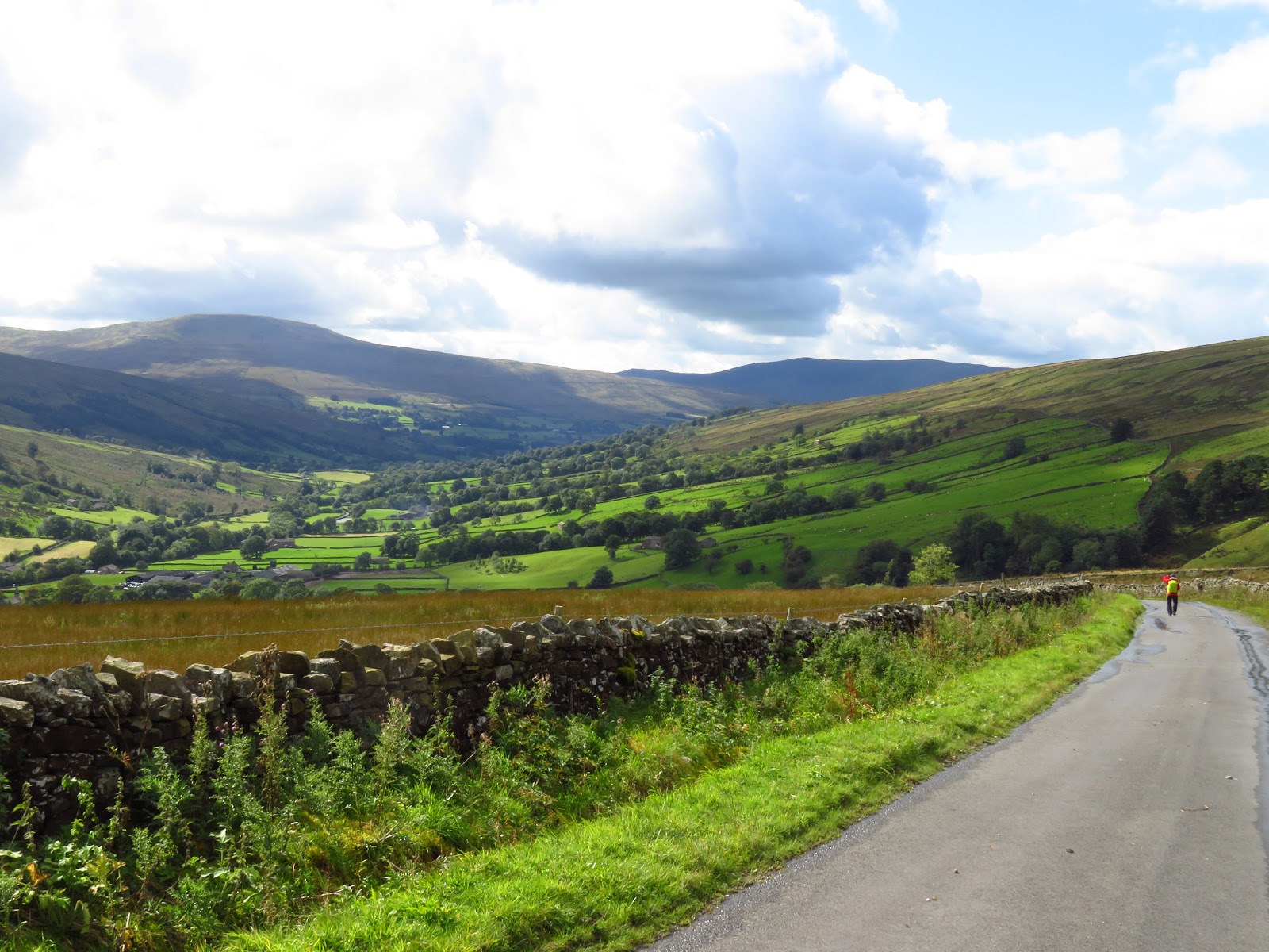
We started in Kettlewell next to its two pubs, the streets still wet from a rain which was just stopping. Our detour occurred leaving town, so we came back and got to depart from Kettlewell a second time, this time along a quiet road. One car came by in the next hour. The valley was full of old stone storehouses, now empty but once upon a time filled with hay. The hillsides were criss-crossed by stone walls, most of them built 2-300 years ago when the enclosure movement saw the land divided up as it was converted from common land into separately-owned sheep meadows. In one of those curious convergences of history, the farmers being dispossessed from the land ended up in factory towns like Leeds where newly-invented machines put them to work creating yarn and woven fabrics with all that wool, plus cotton just starting to come in from the U.S. and India.


We reached our destination of the George Inn, but it was too early so we visited the church just across the way. A local fellow carved little mice into the pews and other woodwork a few hundred years ago, and we spent quite some time finding and photographing a few of the elusive wooden rodents. The church is also famous for a rood arch, a carving that stands in front of the altar. It was disassembled and hidden for a few decades when Protestant extremists were wandering about the land, destroying statues and carvings like this as "Romish" and idolatrous. The mice, apparently, were neither to these gangs.


As we headed out the next morning we passed a drover's road leaving the valley. A few hundred years ago drovers brought sheep on the hoof down these valleys, headed to market. They trusted the towns as being safe, but between towns they preferred to climb up into the treeless meadows. Too many trees and bushes where brigands and sheep thieves might be hiding, down in the valley, you know. We did not encounter any, but we did find the going tough thanks to the wet weather, the occasionally rough trail, and the narrow bridges and stiles. The sheep looked like they would also be an impediment but sheep are -- well -- sheepish, and walk away when they see you getting close.


Our walking was interrupted by two wonders. The first was a stone circle that goes back to the time of the Druids. As with Stonehenge, no one knows quite what it was built for. The second was the shortest river we have ever seen. This area is underlain by limestone, through which rivers are known to flow underground. Sure enough, the river in question emerged from a foot-high "cave," flowed 20 or 30 feet, then sank back into the nether world. How strange!


As it turned out, we were about to be done with the Wharfe River. A short way past a riverside picnic spot we turned around and walked back to our lodging for that night.


This step was part of the plan our walking company had set out for us, since the walk to the lodging that day would otherwise have been too short, and the next day too long. A taxi was to pick us up the next morning and take us back up the valley, and we were to then continue to the top of the valley, across the moorland and down into a new valley.
But we decided otherwise. The temperature was to be in the low 50s. Headwinds were predicted at 18-20 mph. Rain, not showers, was expected. The mileage was said to be 12, which probably meant 14 when you factored in detours, getting lost, etc. And it was the hilliest segment on the whole route.
So when the taxi came the next morning, our driver took us down the valley to a bus, which took us to a train, which brought us within 2 miles of that night's lodging. We missed walking across the moor once again, but we also missed some truly rotten weather, and that's a trade-off we could live with. Here is the map showing our two skipped sections.


Over the entrance of Skipton Castle is the Clifford Family motto, Desormais (Henceforth). During the English Civil War a garrison of 300 Royalist soldiers held fast the fort during three years of siege by the Parliamentary rebels. They never surrendered, but rather left under a truce when it became obvious the Royalists had lost everywhere else. The castle was allowed to stay in the Clifford family on the condition its defenses were removed. Lady Anne Clifford did just that and planted a yew tree in 1659 to celebrate the end of the reconstruction, which still stands in the courtyard. But Lady Anne died without heirs in 1676, and the castle ended up in other hands after all.


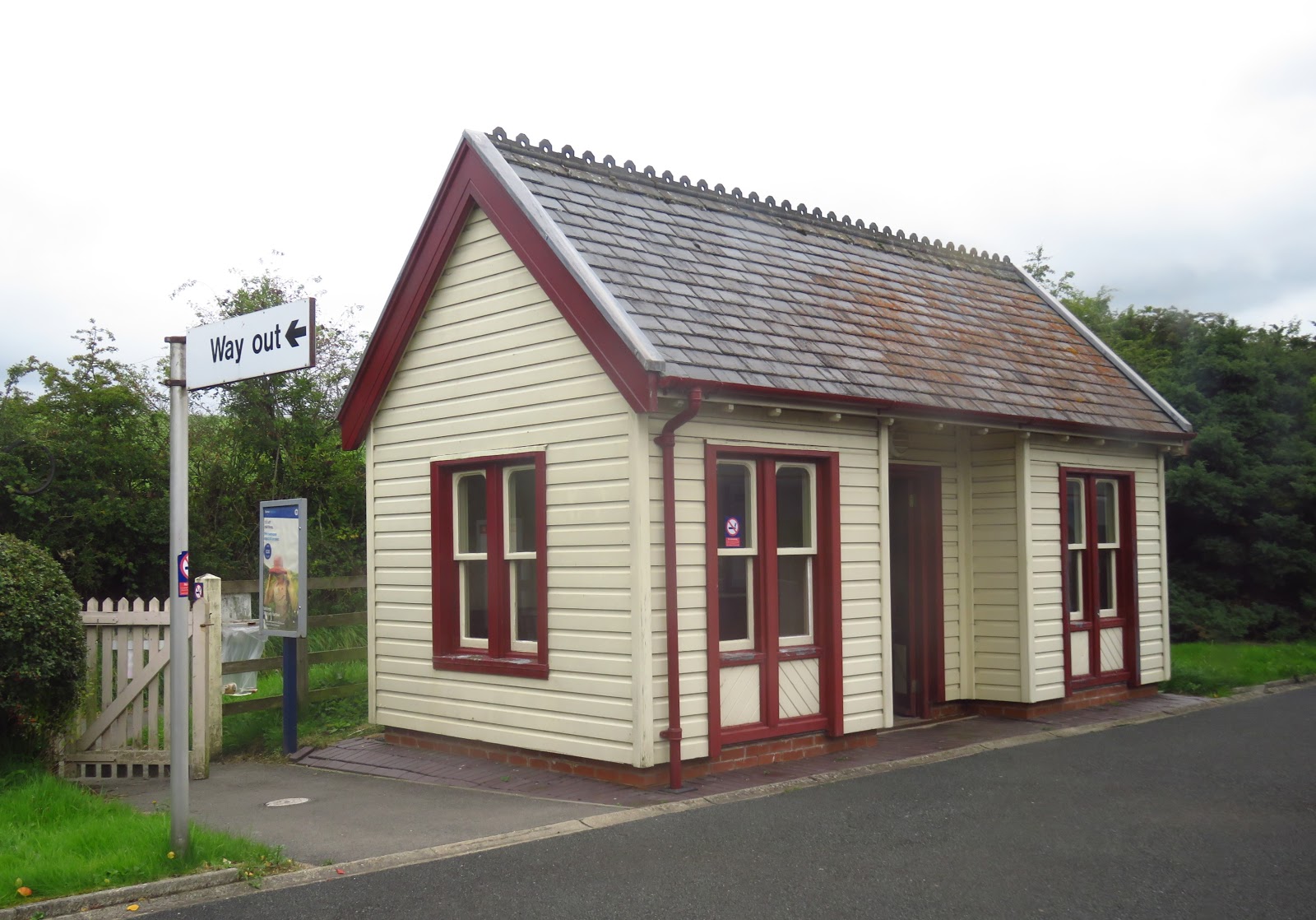
The train was again the Carlisle and Settle Line, except that this time we alighted at Dent Station. Some cranberry-colored heather was growing next to the station, the only time we got close to this vibrant flower that we have seen from below as it has colored the high moors.


We descended a mile into the valley of the River Dee, which we would be following the next day. To our left was the Arten Gill Viaduct, over which our train had just ridden, and which we showed you other photos of earlier in today's blog entry. Down in the valley, hidden by the foliage, was our lodging for the night, The Sportsmen's Lodge. Inside, it was obvious that everyone staying there was hiking the Dales Way. We ran into a fellow-hiker we had met a day or two before, who confirmed that we would have had a very long wet and windy day on the high moors, had we plunged forward as he had.


The roads were almost always dry. In the one or two instances where we had to walk through puddles, they proved to be shallow enough for our more-or-less waterproof hiking shoes.

But we could not do the whole walk on roads, as the route sometimes had to cut through pastures and down along waterways where there were no nearby roads. This usually went OK, but not always.


That last one was a humdinger, and we were lucky we did not have our shoes sucked off our feet by the mud.
We continued to see quite a few sheep, including one who seemed to have fallen asleep and a neighbor who was headed that way. We wonder if he or she was counting humans? Meanwhile others grazed contentedly, while the hills above turned lavender-red once again with swatches of blossoming heather.


We increasingly saw cows, including some belted varieties and another group displaying inter-breedal harmony.


As we neared Sedbergh we had a good preview of this, our destination for the night, and also of what the Brits call a "great house" on the edge of town. But an even greater house was this cottage we passed on the way in, and its owner. She won an award for the best small house garden in England one year, she was pleased to tell us, but she regretted she wasn't quite keeping it "up to snuff" since her husband passed away a few years ago. Don't know about your snuff but it seemed quite up to ours, and a long way beyond!


She wasn't the only person with creative genius in that town. Her neighbor cracked us up with some rubber boot art.
We continued next day on roads rather than the Dales Way path that we feared would bog us down again in mud. It was hillier, but when you climb a hill you generally get a view, and we got plenty. At times we were at the edge of the cultivated part of these valleys, with only the moorland to our right. Except that we were in one of those areas (Scotland and the Isle of Man are the others) where the term "fell" is preferred over "moor," a linguistic remnant of the Viking invasions of England that began in 793.


At times the roadway was closed in by hedges that could climb over 10 feet. We listened carefully for cars coming around these blind turns, but few came at all, and none at a time we were in an awkward spot. Another danger was a plant we never learned the name of, but which we did learn to avoid. Just the slightest rubbing of the fine teeth on both its stem and its leaves against your skin, and you were soon grinding your own teeth in pain.


From our perch on the hill we got a long, long preview of the Lowgill Viaduct and its 11 arches, the highest of which is equal to a 9-story building. It sits by itself today, unconnected to any train line or trail, as useful and brooding as one of those Easter Island figures. When we got closer we could see that it is "bleeding" lime from its joints. Hopefully this is no more than a cosmetic issue.


We crossed the Crook of Lune Bridge and sat down on a stone to have a picnic lunch. The owner of a house nearby spotted us, came by to chat, then left and returned with cups of tea. Then he invited us in to see his house! It was a former mill built in the 1750s (that's the millstream next to it), and he had converted the ancient wooden mill wheel into a wine cellar!


As for the B&B, it more than made up for things. It was a classy remodel of an old stone barn. There are no restaurants nearby, so part of the deal is that the owner drives you 6 miles in to Kendal, where there are dozens of them, then picks you up when you're done.

For our eighth day we started out again taking roads rather than the Dales Way trail, and found our own sort of beauty in the countryside and small towns we walked through. Back on the trail before lunchtime we spotted Kendal in the distance. The trail misses it by several miles, though some walkers stay overnight there by taking a train from a town that is on the trail.


The Dales Way is not all footpath -- 15 or 20% of it does in fact consist of country roads, and one such stretch took us past Burneside Hall. The impressive towers went up in the late 1300s. The rest has been patched on over the centuries. It remains a working farm. Just beyond the Dales Way turned to take one more footpath, but we kept on and found a road that was certainly as atmospheric as any trail nearby.


At last, the final day! We stayed on the Dales Way route almost the whole day, and encountered no significant mud or other problems. We were now in the northern reaches of the Pennines, the mountain range that runs up the west side of England, and the air was reasonably clear so the views were good.


We weren't above the timber line, but it was quite open and rocky, and almost treeless.


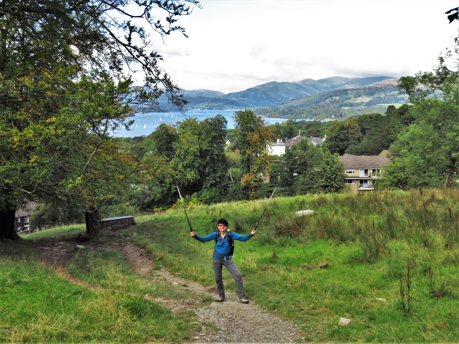
Finally, what we had been straining to see all day came into view -- Lake Windermere far below us, at this point only a thin line of blue water hidden by hills, even though it is the largest lake in England.

It was a loooong way down to the lake, and hiking downhill is not all that much easier than going uphill. But the end was near, so it was time to celebrate, then catch our breath at a bench marking the official end of the Dales Way.

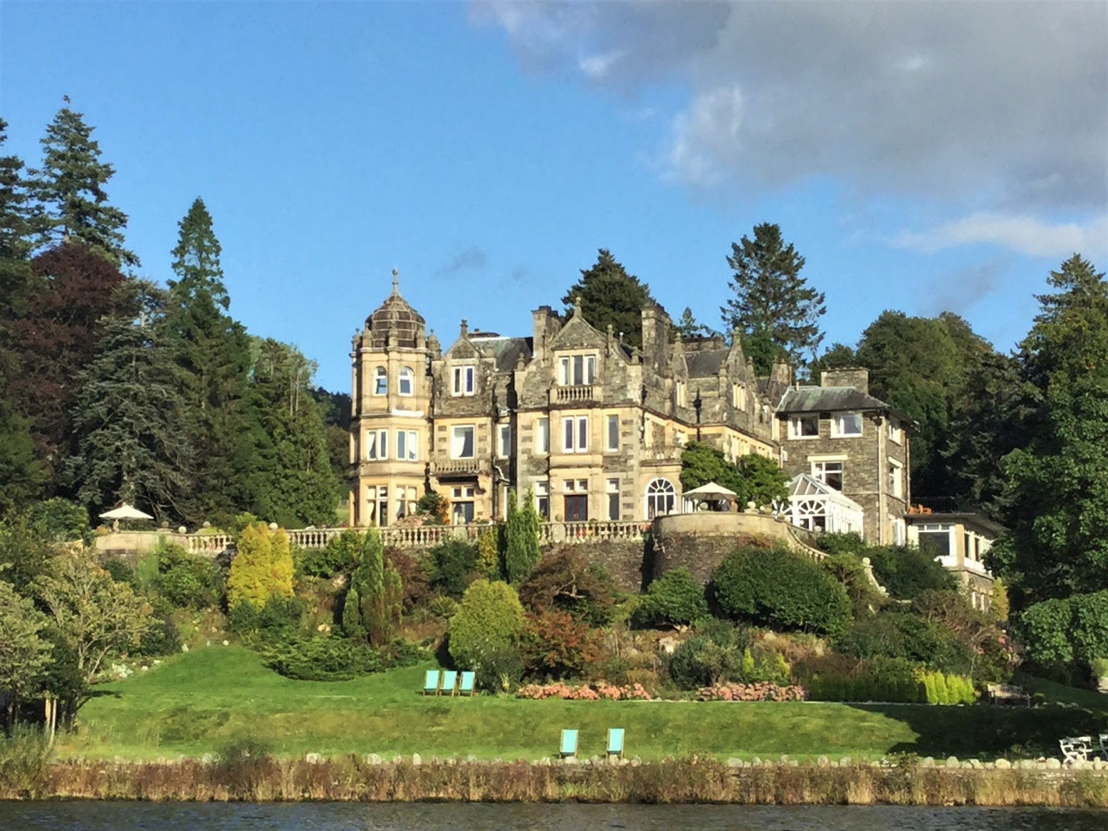
Before heading back to London we spent two more nights close to Windermere, in the town of Ambleside. We took a boat ride partway across the calm lake to Wray Castle, a mock-Gothic "castle" built by a mid-Victorian doctor as a summer home. It is now owned by the National Trust.


From there we hiked along the shore to another boat landing, where we took a pair of boats that brought us back to Ambleside via a stop for lunch along the way. As you can see, we did get a good look at this large lake, the mansions that line it and the mountains that loom over it!


This has been an interesting adventure. We are no strangers to long bike trips, as our regular readers well know, but we have never before done a long hike. The hiking company helped us with logistics in a country which was so sufficiently foreign to us, that we needed such help. Our next trip, if there is to be one (a possibility but not yet a probability) is one we could and would plan ourselves, for a bit less money and a much more accommodating pace.
But we are also so very happy to have done this hike. The landscape was glorious, and the challenge is one we were able to meet, albeit with a few tweaks such as some taxi and bus rides. We've come away understanding, and deeply loving, this part of England.
Our next and final stop for this year's trip is a five-night stay in London. We'll take you there in our next and final blog post for 2017.

No comments:
Post a Comment