

It was now time to head south, us by bike and them by car, except that they joined us on their tandem for the first 22 km of that journey before returning to their car. But our parting was short, just long enough for us to bike the 350 km (shown in red on the map) to Strijen, their home in South Holland, by way of three other provinces.
We parted in De Rijp, a quaint town in a part of North Holland overloaded with charm. Though today De Rijp is not very large, it was important enough a few centuries ago to have been granted the right to have a Waag, or Weigh House, which is still standing and still most attractive. There's a canal going through town, as in so very many Dutch towns. Not sure I'd want to have been in the passenger seat of the first or second car, though, when the driver finally found his parking spot.


Marken then ceased to be an island in 1957, or at least an island only reachable by boat, when a causeway joined it with the rest of the country. Nonetheless, it draws tourists by the busload and boatload (there's also a ferry there from Volendam), thanks to its distinct architecture and history. We wandered about with the camera, and here are a few shots.


And of course we biked out to the lighthouse and took its picture, as it's reputed to be the most-photographed lighthouse in the Netherlands.

So far, quite peaceful. But we were now about to spend several days visiting and sleeping in a variety of fortified places: a fort, three Vestingstaden or fortress cities, and one absolutely charming castle where our lodging was in the oldest part of the castle -- 800 years old!
But first, as we brushed by Amsterdam, we crossed a stunning bridge we had to stop and admire because it was built just for bicycles and pedestrians, carrying them over the Amsterdam-Rhine Canal. It's infrastructure like this that keeps bringing us back to this bike-loving country.


We're happy to say they have installed modern facilities in the castle, so the visit was quite pleasant after all. The place was first built in the 1200s, then sacked, then rebuilt, then remodeled. But it has indeed played a part in the defense of the country, as it guards the shore of the former Zuiderzee at the mouth of the river that leads to Utrecht, now filled with pleasure boats.


We enjoyed a picnic lunch in the castle garden outside the walls, then entered for a tour. Among the highlights was the lord and lady's bedroom, with the sort of short bed we've seen before -- until the 19th century it was considered unhealthy to actually lie down in a bed, so folks slept more or less sitting up. The painting next to the bed shows how to properly swaddle a baby to have him or her turn out right. The last painting shows a young boy. Until they were potty-trained, both boys and girls wore the same outfit. Gosh, talk about putting pressure on the boys to get it right. Our guide said the boys couldn't wait to get out of what they considered to be girls' dresses.


A dozen km to the east, also close to the shore of the former Zuiderzee, was the first of our fortress cities, Naarden. Here's how it looks in Google Maps and in Google Earth:


And here it is from the outside:


The star shape meant that there was no way an enemy could get so close to the walls that you could not shoot him. And you never relied on just one set of walls -- every fortress city we have visited has had several layers of walls to keep the battle as far as possible from the city itself.
Parts of the walls, or at least the pattern of the walls, may be as old as 700 years, but other parts are from the 1800s, such as the ramparts on the east side of town.

Dutch towns tend to be fairly compact, but fortress towns of necessity are even more so, since land is so precious. Naarden was no exception.

 As we headed south for our next destination, we had both 2-legged and 4-legged travelling companions along the bike trail.
 We were headed through an area we had seen marked on the map as Nationaal Park Utrechtse Heuvelrug, but we didn't know what to expect when we got there. Turns out it's a sandy area created by deposits from the Rhine that were moved around and added to by the continental glaciers of the Ice Ages. Parts of it were classic sand dunes that have been covered by enough vegetation, especially heather, to be called moors, while other parts had sand dunes that are still shifting about, and occasionally covering over the moorland that is trying to make a go of it in this unfriendly environment.


Ironically, this poor soil is near the prosperous cities of Hilversum and Utrecht, and neighborhoods of lovely homes abutted the national park, with many of these residential streets having bike and pedestrian access. We couldn't help wandering there as well, and admiring these places. As several of them showed, thatch roofs are not just for simple cottages.


These folks might like to think of their homes as their castles, but it was to a real castle that we were now headed, specifically Kasteel (Castle) Starkenburg. The tower dates back to around 1200 AD.


The room does come with a throne, unfortunately of the porcelain variety, hiding behind a wooden cabinet that swings open between the bed and the bathtub that Louise is trying out for size.

Meanwhile, Jeff went to the window to demonstrate the thickness of the walls. They're thick.

We did do a few more turns up the circular staircase to check out the room above, which was vacant that evening. Even grander, we thought, but the prospect of climbing that night (and descending the next morning) yet another 20 feet on that narrow staircase with our bike panniers, rack trunk, handlebar bag and two pairs of water bottles quickly changed our minds from asking about shifting rooms.

Without the luggage we climbed yet again to the roof of that lofty upper bedroom for the view, which was quite nice. We also found a print of the castle in the 17th or 18th century, prior to the last remodeling. And then in the morning we tracked down one of the many chickens roaming about, a nice medieval touch, since having chickens wandering about was one of the few ways one obtained fresh meat for dinner.


The area around Starkenburg turns out to be full of castles and grand houses, though perhaps not ones open for an overnight. Here's one just a few kilometers away with a lawn you don't ask the kid next door to mow. Since the house is so far away, we put the camera on telephoto to see what it actually looks like. Can you imagine not being able to see your own house clearly from one end of your front yard? Any of our readers have that problem?


We've come a ways to the south and crossed the Rhine-Amsterdam Canal a second time, the last time just outside Amsterdam a few dozen photos above. This time the focus is on one of the emergency gates that can be lowered should there be a break in the canal or, more likely, a surge of water in the Rhine itself, which is right around the corner from here. The Maas, which come from France and Belgium has made a sharp turn to the west and is now parallel to the Rhine, only a few kilometers away. Like the Rhine, it is a busy waterway, with some sort of ship, anything from a barge to a river cruise boat, almost always in view. This being the Netherlands, there's also a near steady stream of cyclists making their way along the dikes lining both rivers.


We just made it through a few photos without another fort or castle, but that couldn't last in today's blog. We were now in Heusden, yet another Vestingstad, or fortress city. A model in the city tourist office demonstrates the familiar shape of the city.

Heusden is a charming city with a busy harbor right on the Maas River. And what could be more iconically Dutch than a windmill and a hand-operated footbridge?


This was our second visit to Heusden, but our first overnight there, so we've decided to give you a few evening and night scenes for a change of pace.


The last shot is of our hotel, which has a popular terrace restaurant on the main city square. We were luckily on the quiet side of the building. As in so many hotels and even more homes in this country, the stairs were crazy steep. But with all the other nice qualities of the Netherlands, it's not too steep a price to pay for being here.

 We visited yet another Vestingstad, Willemstad, but didn't bother to pull out the camera since it is not terribly different than the two we've shown you. But en route there we did pass a most un-militant place, the Begijnhof of Breda. Begijnhoven or Beguinages in French, are places that were very popular in medieval and late medieval Netherlands, Belgium and northern France. They were a place where older single women, most commonly widows, could find lodging and security in an age where women had few protections. They were not convents and the residents were free to marry, but they were nonetheless religious in a less rigid way, and often under the protection of a church. As near as we could see, the residents today are still all or mostly female and older, though this is no longer a religious community. A sign in the courtyard told the story of the last Begijn, known as sister Cornelia Catharina Frijters, who passed away in 1990, ending 700 years of Begijnen living in this Begijnhof.

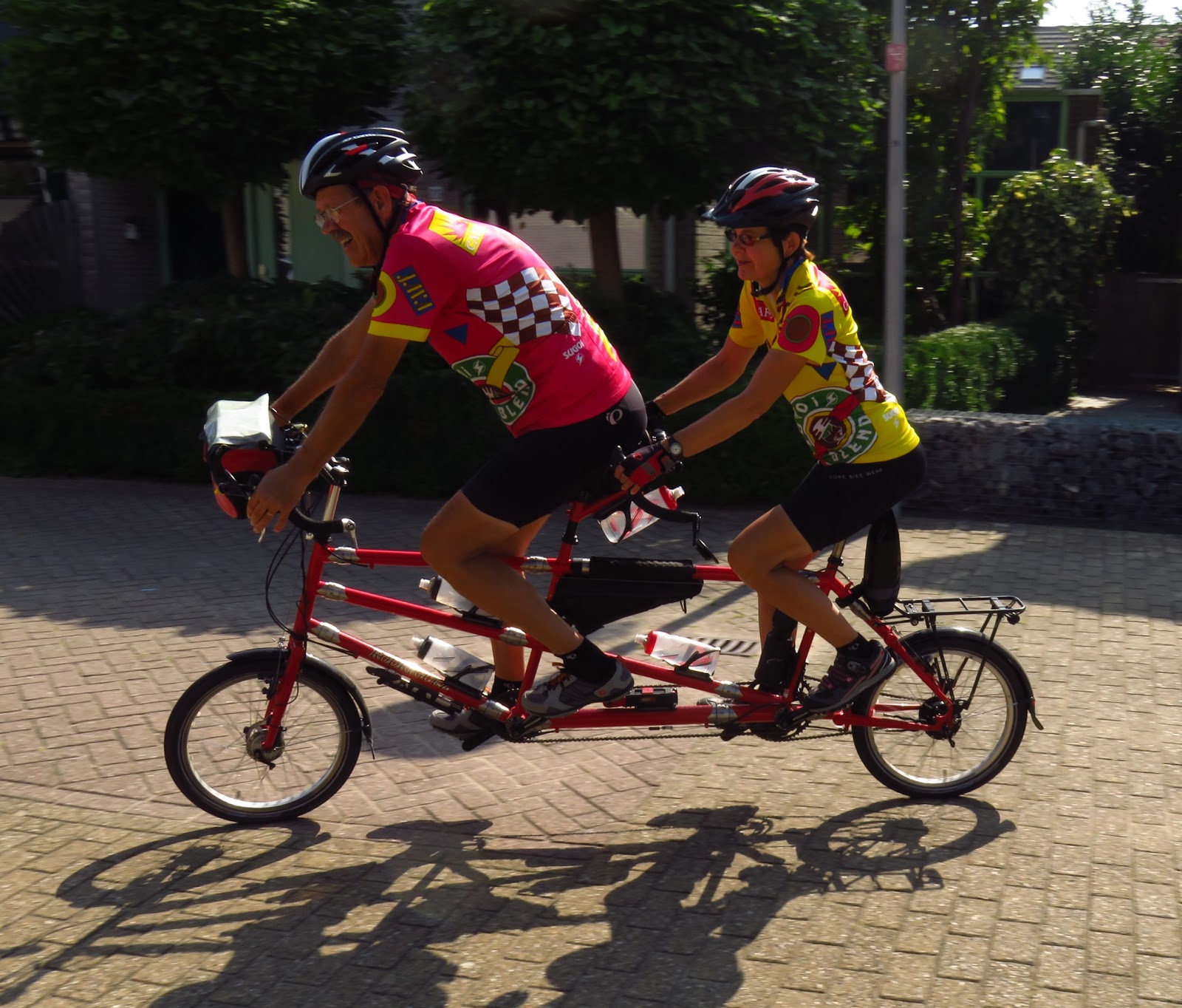
Well, we finally covered those 350 kilometers and rejoined friends Nico and Marga for our final three days in Europe, as their houseguests. We got in two long rides, including an inevitable ferry ride, a visit to a terrace beer garden and a ride past a windmill or two, and managed to take a few pictures of each other.


Our 89th day in the Schengen Zone (most of Europe other than the UK and Ireland) had come, and the need to disassemble our bike for the train trip to England the next day, since as Americans we get only 90 days inside the Schengen Zone or else. We weren't eager to find out what or else the authorities might have for us, so we complied. But we noticed that we were 31 km short of hitting a nice, round 2,500 km for the summer, so off we all went on our two tandems for one last 31-km ride. Marga scooted up ahead and caught Team Redtandem riding their last meters of the summer, ending at their front door.

And with that, it was over.
Except that it isn't.

Marga kindly drove us to the train station the next morning and we hopped on an IC (fast intercity) train to Brussels, where we picked up the Eurostar super-fast (297 kph) train through the Chunnel (the tunnel under the English Channel). We'll close with us and Little Red, now ensconced in the two larger suitcases, as we leave the continent. We'll pick up with the Chunnel and what lies beyond it in our next blog entry. Thanks for joining us as we've cycled through Austria, Germany, Liechtenstein, Switzerland, France and the Netherlands this summer.

No comments:
Post a Comment