
Strasbourg itself is 150 km from Basel, a distance we covered in 3 days of riding plus 1 day of hunkering down on a rainy day and catching up on the blog (the prior entry) and record-keeping (spreadsheets we keep of where we stay, how many miles we've ridden each day, how much money we've spent, etc.).
Only a kilometer or two after entering France from Basel, we joined the Canal de Huningue, first opened in 1828, just three years after the Erie Canal in upstate NY. It allowed small boats to parallel the Rhine for the climb up to Basel. Today it's no longer navigational except for a short stretch at the north end. The former towpath, however, provides a nice route for bikes.


We stopped in a small town and had our first "opportunity" to order lunch in French, a language each of us remembers only dimly from high school. We did manage to order two doner kebabs successfully, but Jeff made the mistake of ordering something larger than his head when his "large" kebab came out. Since it was only 2 euros more than Louise's regular, he thought it would be only a little bit bigger. Big mistake, in fact. For the record, he did NOT finish it.

Both sides of the Rhine are quite agricultural here. Scenes like this next one, of farmers baling hay on the right and loading it by hand onto a truck, were not uncommon. The view is looking east from France, toward the Black Forest on the German side of the Rhine. But when we switched to the German side on day two, it was also mostly rural. The sign lets folks know that the road we were headed down is closed to motor vehicles except for forestry and agricultural workers and those who live there. This is a very common sign on all of the bike routes we have taken in Germany, and it makes for quiet roads for us since we rarely encounter those privileged few who are allowed to drive motor vehicles down them.


We switched to the German side in part to find lodging. The small towns on the French side either didn't have much, or what they had didn't show up on Booking.com, which is our main method for finding the next night's room. But we also wanted to see two towns, one large and one quite small. The large one, Breisach, had a castle ruin that was not worth photographing but it did serve the purpose of getting us high above the town where we could get a good view of the St. Stephen's Muenster, parts of which go back to the 12th century. That is indeed the Rhine to the left of this fortress-like monastery.

The small town was Burkheim. One doesn't just happen upon this place, as it requires a detour from the official bike route and it is a kilometer from anything resembling a through road for everyone else. But tourists were finding it, for obvious reasons. Its charm was enhanced by large photos the town has hung on walls around town, black and white shots taken during the time of the First and Second World Wars. We recreated some of them. Not much had changed!


As we headed down the Rhine, we found it surprising how little of the Rhine we actually saw. On the French side, the route largely went through small towns that were 2-5 km from the river. On the German side the route did follow the river somewhat, though largely by riding on the unpaved dike. It's not bad biking, but a little slower than on paving, with the constant worry that there will be a spot where it gets a little too sandy and unstable. Luckily, that never happened, nor has it in all our travels in Europe, but the few times it has happened to us in the US were memorable, and not in good ways. The view here is one of the spots where the Rhine gets to be itself for a few kilometers. For most of the way between Strasbourg and Basel the river is paralleled by a large canal, the Grand Canal d'Alsace. This has made Basel into Switzerland's sole seaport, as the canal is deep and wide enough for ocean-going boats to reach it, at least ones of more modest size. The ecological impact is another matter, and it is doubtful it would be built today with what has been learned about the need for free-flowing rivers.

The next day it was adrenalin that was flowing as we passed a place called Europa Park. The concept is that different parts of the park captured the essence of different countries in Europe. At least that was what the brochure we picked up in one of our hotels said. From what we could see from outside the park as we rode by, however, the nations of Europe all seemed to be into scaring the dickens out of you. For about 48 euros a day for adults (a little over $50). No thanks!


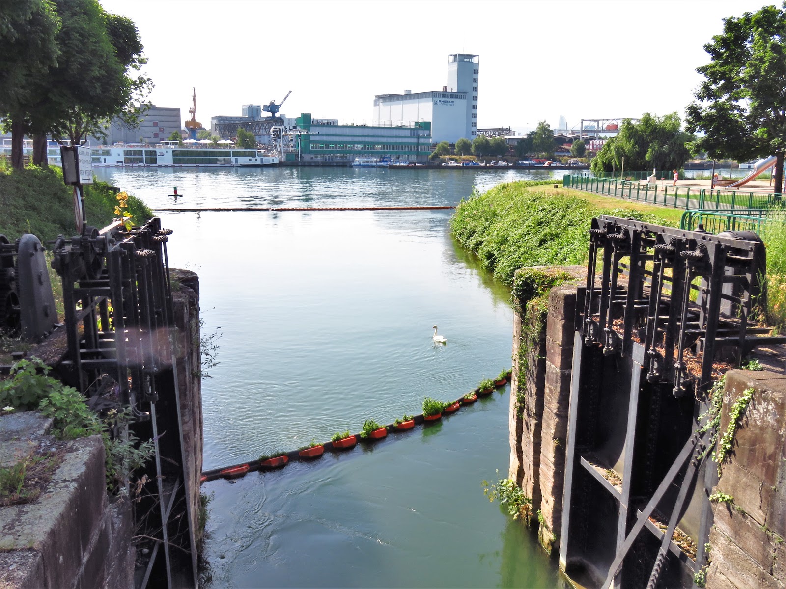
Much more to our taste was the Canal du Rhône au Rhin, a canal built in the 1800s that parallels the Rhine in this area before going deeper into France to connect up with the Rhone River. The portion near Strasbourg is maintained today only for smaller boats. If you look closely, there is a rope dangling from a yellow pole about 50 meters before each lock, which one pulls to let the lock operator know you want to lock through. The old towpath was turned into a bikeway only 6 years ago. It was an absolutely gorgeous route into the city.


 We booked three nights in Strasbourg through Airbnb, and really lucked out. The heart of the city is the cathedral, and the second-most-famous structure is across the plaza from the cathedral, Kamerzell House, formerly owned by a wealthy family that was not shy about displaying their prosperity. Here are two shots, the one to the left at night, the one below by day. The door to our Airbnb apartment is a block back, just left of Kamerzell House in the second photo. In short, we were right in the heart of the most interesting part of the city.
 And not only were we at the heart of the action, we were decibels away from that action. To reach our unit one went through a tunnel to a courtyard. The noise of the street never made it back there. There was, however, one oddity. The courtyard was filled with scaffolding that sits there, more or less permanently, to hold up the building next to us! The cubes are plastic boxes filled with water to hold the whole thing in place. The whole courtyard is 400-500 years old, and not what it used to be. Perhaps one of these days they'll come up with a more elegant solution.
The cathedral is one of the more significant ones in Europe. It started as a Romanesque structure over a thousand years ago, then was transformed from the 13th to the 15th centuries into the Gothic structure we see today. There were supposed to be two spires, but the cost and difficulty of building one of them wore out the city, and the other one was never started. The beautiful red color is from sandstone quarried in the mountains nearby.


Closer to earth, such as around the doorways, the sculptures are mostly biblical, but high up there was a virtual battalion of kings and emperors on horseback. The middle photo, for example, is clearly Charles Martel, a Frankish king from the 8th century.


 Team Redtandem rarely passes up a chance to climb a church tower, so we paid our euros and started upwards. The top of the spire is 142 m (466 feet), the tallest building in Christendom until 1874, when Hamburg pushed its cathedral up 5 m higher. The public, however, only gets to go to the height of the unbuilt tower base, 66 m (216 feet), or about 22 stories tall. That was still high enough for some fine views of the European Parliament buildings about 2 km to the northeast; of the Rohan Palace below us, former home of bishops and cardinals of the church; and of the oldest parts of the city with narrow streets, alleys and courtyards, to the west and southwest.

And, of course, one cannot help admiring the gargoyles on the way up and back down. The ones here were more amusing than scary.


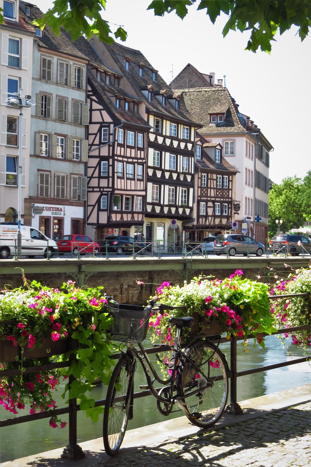
The most photogenic part of the city is certainly the one known alternately as La Petite France and also as Quartier des Tanneurs, or the Tanners' Quarter. It was actually home of both tanners and fishermen, but now is overrun with tourists oohing and aahing the half-timbered houses and the many flower boxes.


One of the curiosities of Alsatian architecture is its love of ultra-tall roofs and numerous dormers. Here are just a few examples, not only on houses and businesses but even on churches:


 In case you've ever wondered how one builds a half-timbered house, we found one under construction or perhaps reconstruction, showing how they do it nowadays with the help of a plywood backing.
Our last full day in Strasbourg was July 13th, the eve of Bastille Day. We visited the Place de la République in the afternoon, where a recruiter for the French Foreign Legion was putting the finishing touches on a display. Loved the last reason for joining: a second chance! A few hours later we heard the military bands and the crowds applauding them from a kilometer away as they celebrated a Prix d'Armes there, in front of a flag-bedecked building that was actually built by the Prussians in the wake of their annexation of the Alsace in 1871. On a more somber note, the plaza also holds a statue of a mother holding the dead bodies of her two sons, one who died in WW I fighting for Germany, one for France. We understand that this had been far from an unusual situation in Alsace. And lest we forget, the end of the Second World War was also not the end of warfare for France. The war memorial in the Place de la République reminds us that France had another 9 years of warfare in Indochina, ending only with their defeat at Dien Bien Phu in 1954, and some ten years of war in Algeria before giving up their futile dream of a French overseas empire.


We hope you have enjoyed our foray into this little part of the Rhine where Germany and France interact, and one can find classic French canal scenes and good German Flammkuchen, a sort of Teutonic pizza. In our next entry we will continue north on the Rhine toward Mainz.


No comments:
Post a Comment