

We passed some hills starting near Meissen and continuing past Dresden, but as we got another 20 km down the road those hills turned into mountains. The formal name is the Elbe Sandstone Mountains, but ever since some Swiss painters working in Dresden two hundred years ago said they looked like home, they've been called "Saxon Switzerland" on the German side of the border, and "Bohemian Switzerland" on the Czech side. The most iconic view is from a rocky outcrop called die Bastei, old German for "bastion," and yes we climbed up there from the river to see this spectacular sight for ourselves.
But first let's back up a little. A short ways from our last stop, Pillnitz, we came to the town of Pirna. For several years, the painter Canaletto called it home, and painted its marketplace in the 1750s. Hasn't changed much, aside from the mobile cheese trucks that now come to the market.


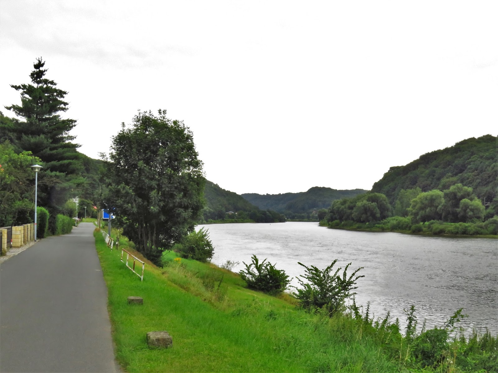
The mountains truly begin just past Pirna, though we had a hard time seeing them from the bike since we were on the right bank (FYI the convention is to name the banks as one looks downstream), as were the most dramatic parts of the mountains. However we did have wonderful views of the river from our largely traffic-free road.

We booked two nights at a wonderful hotel near the river and did a shorter hike after checking in and getting changed into hiking clothes. That's our window at the top of the next photo, and the views started pretty much as soon as our feet were in motion on the hiking path that runs by the front of the hotel. It was a nice climb to get us limbered up for the main event the next day.


Just a bit more climbing and we come to an improbable place, a fortress that was once fashioned out of these rocky high points. It must have been hazardous to health to move about before these steel walkways came in! It was even more hazardous to come up uninvited, as this reconstructed catapult shows.


It was also hazardous for just plain folks who started coming up to the Bastei in large numbers in the middle of the 19th century. In the 1860s the king of Saxony accommodated them with the formidable Bastei Bridge, now another 'must photograph.' For some idea of what it was like before the bridge, we have a painting done about 40 years earlier by Caspar David Friedrich.


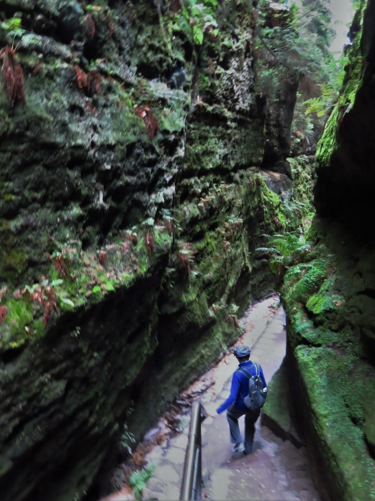
 Not all the great views are of the bridge and the river. Here are a few looking away from the river and into the heart of these eroded sandstone mountains.


It was still only 2 o'clock, so we did one more hike, up the much less visited 'Little Bastei.' It was a pleasant climb, much shorter and almost devoid of other hikers. From the top we got a great preview of our route further up the Elbe (we start with that ferry across to the left bank). A close-up shows just how popular this area is for bike touring: just in this one shot we can see 12 pannier-laden bikes!


Next morning we took the ferry across just in time to see a Viking cruise boat go by, with a sidewheeeled steamboat right behind it. These steamboats run up and down about 50 km of the Elbe from Dresden to Schmilka, the last town in Germany before the Czech border, and provide a nice alternative to the trains which also stop at all these towns in Saxon Switzerland.

Although we didn't stop and climb up to it, we did get a closer look at Festung Königstein as we rode
under it on the left bank.

Soon after it was yet another ferry back to the right bank to visit Bad Schandau, where we checked in early, got into hiking clothes, and took the 118-year-old Kirnitzschtalbahn trolley 8 km (the full extent of the line!) for another hike. It was a fairly rough trail, so the best part of the adventure was in fact the trolley ride up this narrow valley. That and finding a German name with six consecutive consonants uninterrupted by a vowel!


10 km into our ride the next morning and we reached another milestone, and a stopping point for today's blog -- the Czech border at Hřensko. It is the lowest point in the Czech Republic, as the Kamenice River joins the Elbe, now called the Labe in Czech. The Kamenice valley is a major entry point into the so-called Bohemian Switzerland and a new (2000) national park. Since we did not have good info on how hilly it might be, we decided not to find out the hard way and kept going along the Elbe/Labe and enjoyed the view of Bohemian Switzerland from there.


Crossing the border into the Czech Republic we were greeted by a sign that was reassuring and unsettling at the same time: it was clearly put up there for cyclists, but what the heck did it actually say? Czech is a Slavic language with little resemblance to anything we know. How will we do? Well, check back in a few days when we've made it to Prague and we'll let you know!


No comments:
Post a Comment