

An area of marshes, lakes and lowlands east of today's North Holland was altered by two huge storms in the 1200s that created a large saltwater extension of the North Sea, which came to be called the Zuiderzee, or South Sea. In 1932 the Dutch completed an enormous 32-km-long dike, the Afsluitdijk, that closed off access to the sea. It has subsequently become Europe's largest freshwater lake, now known as the IJsselmeer. In 1975 it was itself divided in two by another huge dike. Both are drivable and bikable, though perhaps a bit boring, but we chose instead to cross by ferry, an interesting experience we described in our last posting.
We were now in Enkhuizen, where the Zuiderzee Museum celebrates the history and culture of this region. It was drastically altered by the 1932 closing off of the sea, ending almost all shipping and most of the fishing.
The museum has two parts, an "outdoor museum" with buildings from communities all around the Zuiderzee, and a more typical indoor museum. In the former we saw at least 3 dozen homes, shops, workshops and herring drying sheds. Some of the more interesting buildings to us were this century-old hairdressing salon, a cheese shop, a game of nine pins set up for the kiddies to try, and the schoolhouse with wooden clogs lined up outside the schoolroom.


 The next morning we took off from the wonderful Hotel de Koepoort, "The Cow-gate Hotel," so-named because farmers used to enter town through this fanciful gate when the town was walled. Our ride that day was a mere 23 km, not quite 15 miles, since rain was threatening and we had another head wind howling at us at 18 mph. It misted off and on but we were spared another soaking, and as a side benefit we had lots of time to explore the town of Hoorn. There was much to admire, such as the Waag (weigh house) turned into a lively restaurant, the former Dutch East India Building, now a gourmet restaurant, and various other places. Not sure what the deal is with the superman-wannabe statue on one of them -- Lonely Planet forgot to mention it.


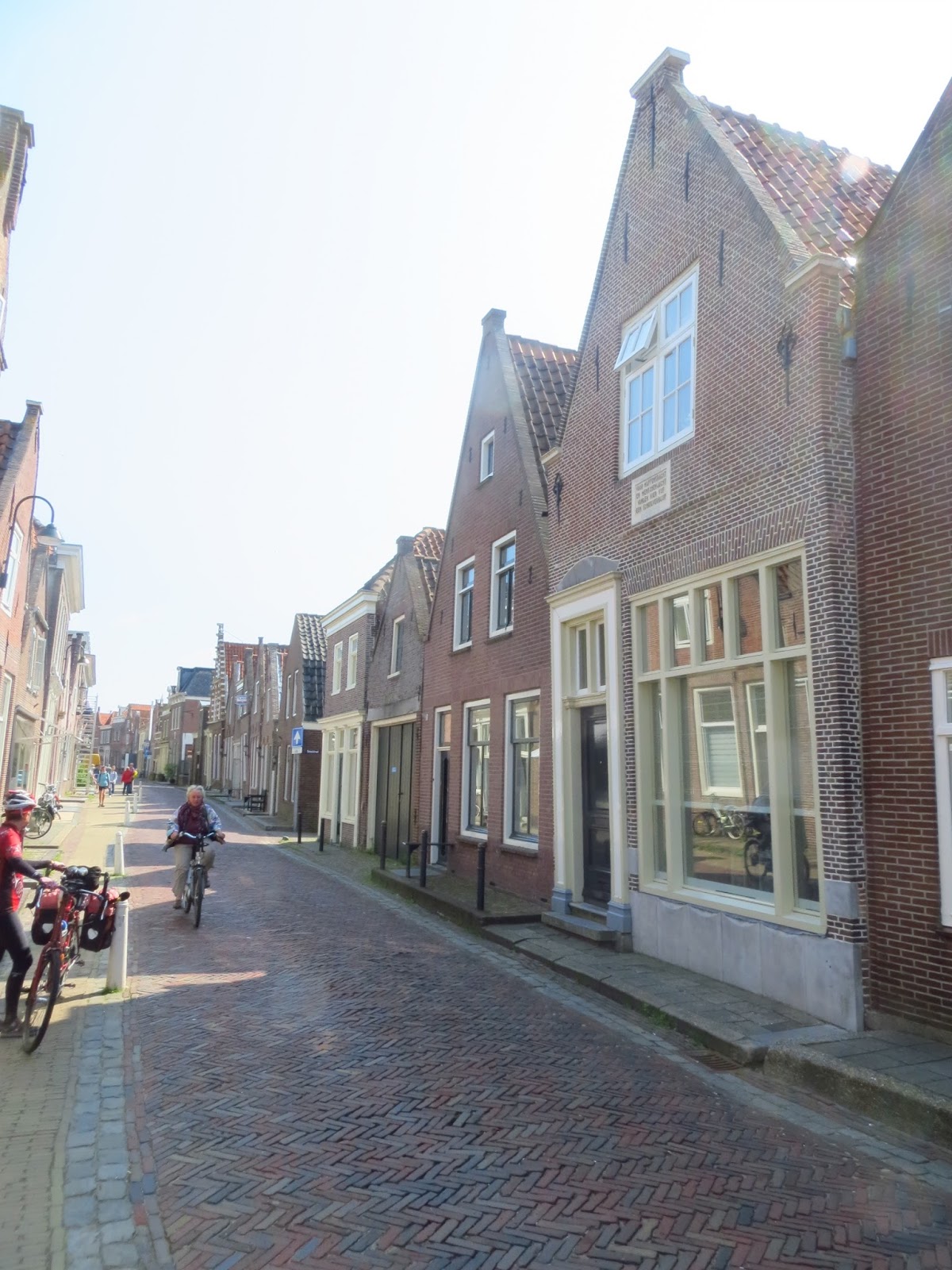
Lonely Planet did mention leaning buildings, and it was hard not to notice a few dozen. We've seen some in many towns around the country, but Hoorn seems to have more than its share. Perhaps it's the soil?


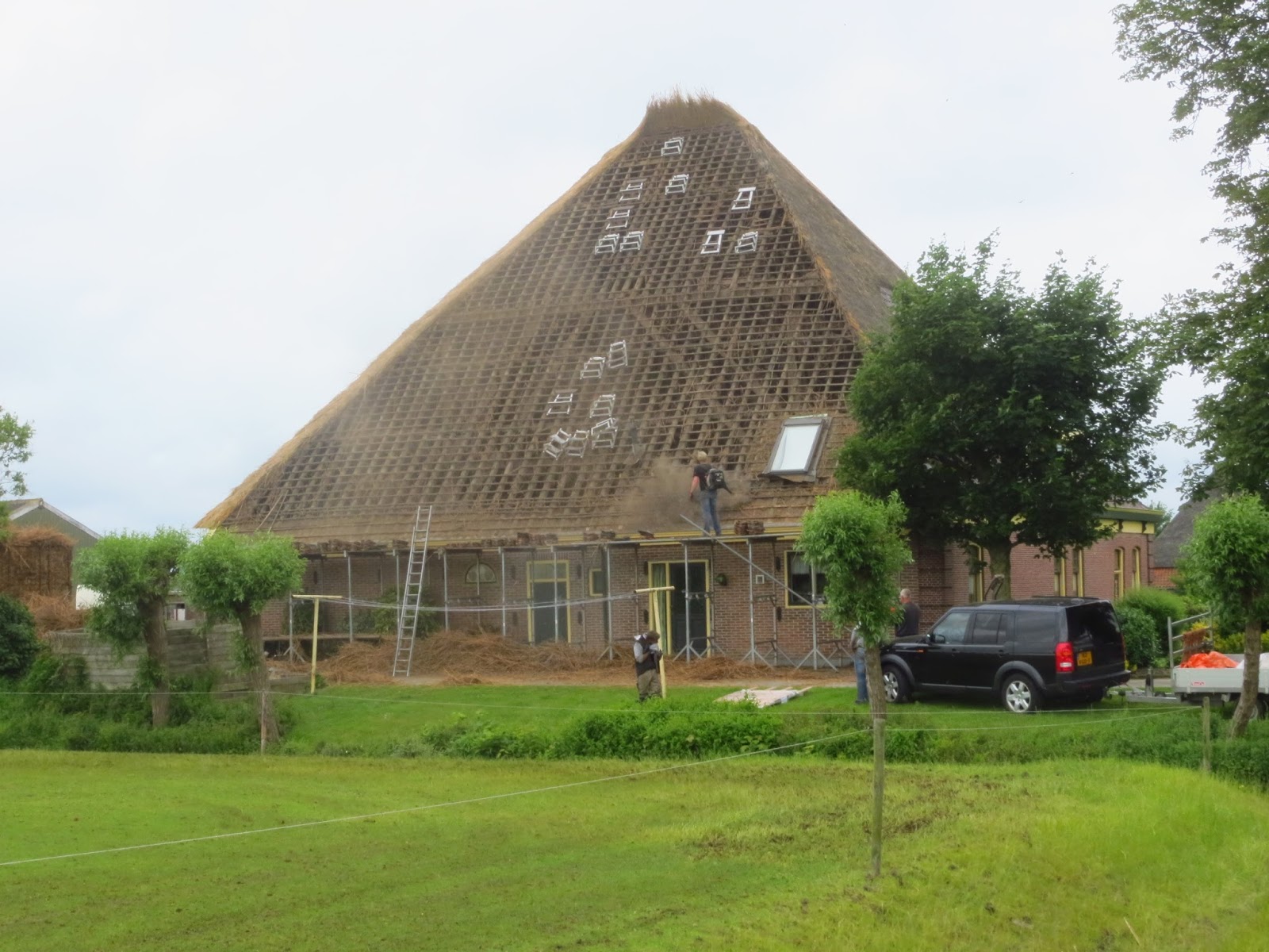
The unplanned highlight of the next day was a ten-minute stop to watch a roof rethatching in progress. Now to find someone who lives under a thatched roof to explain to us the pluses and minuses of one. The first photo shows one side being cleaned of the old thatch, plus a bundle of straw in the back yard getting ready for installation. The second photo shows one side re-thatched and one old section of roof yet to be redone, and the third photo is of a nearby home showing roughly what the finished job will look like. By the way, this is a fairly typical two-way road in Holland. You drive your car down the center until a car drives at you and you move to the right, or you come to a pedestrian or cyclist on your side and move left. This particular truck driver is just having a hard time remembering when to go right and when to go left.


 Another unplanned surprise was in the back corner of the graveyard surrounding a country church we stopped to admire. Behind rows of stones commemorating, in Dutch, the beloved husbands, wives and children of the community, there were three gravestones in English. By googling their last names together, we later learned that they were on a bombing mission headed to Germany that unfortunately ended in this small town 73 years ago.

Our destination was "the land of 1000 islands," a place in northwestern Noord Holland where farmers used to get from farm plot to farm plot by rowboat, each island plot ranging in size from a large city block down to the size of a suburban house on a small lot. A portion has been preserved by the museum, which also re-creates for tourists how the farmers would row into a large shed and sell their crops to wholesalers right from their rowboats. We skipped that (just a little pricier and hokeyer than we care for) but rode around a few hundred of the islands, now looking like -- surprise -- suburban houses that simply have canals in place of fences between neighbors.

The following day we rode a tail wind past two dozen historic windmills, a few of which thoughtfully clustered themselves for our camera. It was only 4 days after the summer solstice, and that night we watched the sun set from our garret hotel room in Volendam, at 10:06 pm!!! We hadn't fully realized before this trip just how far North Holland is. The southermost point in the Netherlands is still further north than anyplace in the U.S. except Alaska, and these late sunsets and early sunrises are making it extremely challenging to get as much sleep as our bodies are telling us we need to get. Then again, "restful vacation" is not a term we get to use very often.


From Volendam we rode along the shore of the IJsselmeer to Monnickendam, not really a tourist destination, yet our guidebook was able to lead us to three photogenic houses: one from 1611 with small leaded glass and curious horizontal shutters; another from 1620; and a third that Louise is standing across from, which somehow succeeded in sheltering five Jews during Holland's five-year-long occupation by the Nazis.

There are two famous collections of historic windmills in the Netherlands, a larger one we will miss at Kinderdijk, and the one we visited at Zaanse Schans, on the busy Zaan River. On any given day 2-4 of them are operating and open for visitors, at €3 per windmill. We were like kids in a candy store trying to decide which of many treats to buy, then settled on the 1676 "De Zoeker," a mill that extracted peanut oil. It's the middle one in the first photo, the near one in the second.


First the peanuts are crushed by two stones rolling over them, each stone weighing more than two average automobiles. Wooden scoops direct the crushed peanuts back under the next wheel. Then the peanut flour is heated on a stove heated by briquettes (in the old days by peat), put into woolen bags, and then pounded by wind-powered hammers. They don't pound away anymore since millers used to become victim to what was called "pounding deafness." The miller then sold peanut oil for cooking and the cakes of oil-extracted peanuts to cattle farmers. We climbed upstairs to look at the machinery up close and very, very carefully -- this is actually a pretty dangerous place, with all that heavy wood spinning and grinding. As we returned to our B&B, itself built in 1680, a neighbor had a statuette in a window showing just how much the local cows like their peanut cakes.


 Like many old Dutch cities, there is a massive cathedral at the center of Haarlem, already about 250 years old when this print showed the city skyline in 1686. It's named after a saint you don't hear about on our usual side of the Atlantic, Saint Bavo, and is longer than a football field, end zones included. Its most famous feature is an organ with 5,000 pipes and a list of notables who have performed on it, including Handel and Mozart! There are also a few stunning ship's models hanging above the congregation, a gift from the Shipbuilders Guild that constructed the full-sized versions in the 16th and 17th centuries.


Haarlem's most famous son is the painter Fran's Hals, and a fine museum is a short walk from St. Bavo's. In a gallery with several of his renowned paintings of officers of the St. George Civic Guard was a recreation of a banquet table like those in the paintings -- a nice touch!

The museum also had a 1696 painting by Gerrit Berckheyde of St. bavo's cathedral in Grote Markt (the large market square), with the Meat Market in the elaborate building to the right of the church and the nondescript Fish Market hiding in the shadows of the church's north side, a medieval solution for the short shelf life of fish when there's no ice maker handy. Of course this painting was a challenge to us, and we think we got pretty darned close to where the painter stood with his easel. Not much change, but then it's only been 317 years.


It's only a thirty-minute bike ride from Haarlem to the sea, and we'll resume our blog next time at the beaches and dunes of Zandvoort.

No comments:
Post a Comment