Greetings from Fiordland, an enormous national park that takes up the entire SW corner of the South Island of New Zealand. It's roughly 50 miles wide and 150 miles long, and the coast is deeply indented by deep, deep fiords. You can link to a detailed map here at http://images.google.com/imgres?imgurl=http://www.fiordland.org.nz/images/Fiordland-Map.jpg&imgrefurl=http://www.fiordland.org.nz/Travel-Guide/Maps/Fiordland-Region.asp&usg=__f3HNf_7pdLReYTqSn6uFEpMLlXw=&h=591&w=500&sz=32&hl=en&start=1&tbnid=F3URdPAxf42IvM:&tbnh=135&tbnw=114&prev=/images%3Fq%3Dfiordland%2Bmap%26gbv%3D2%26hl%3Den%26sa%3DG.
For all its size, it's not an easy place to access. You can enter from the sea, of course, but there are no ports within 50 miles of the first fiord, so only a handful of cruise ships come in en route from NZ to Australia, and few other sightseeing boats by that route. By land your options are quite limited unless you're into 3- to 5-day backpacking over 3,000' climbs. Louise did that 15 years ago and it was quite a challenge in her 40's, both from the climbing and from the sandflies who wait along the trail to welcome you in numbers equal to bike fans along the Tour de France route.
For all its size, it's not an easy place to access. You can enter from the sea, of course, but there are no ports within 50 miles of the first fiord, so only a handful of cruise ships come in en route from NZ to Australia, and few other sightseeing boats by that route. By land your options are quite limited unless you're into 3- to 5-day backpacking over 3,000' climbs. Louise did that 15 years ago and it was quite a challenge in her 40's, both from the climbing and from the sandflies who wait along the trail to welcome you in numbers equal to bike fans along the Tour de France route.
Needless to say, we chose the easier way of accessing two of the fiords, Milford Sound and Doubtful Sound. They're called "sounds" because the sealers and whalers got here first and were not sophisticated geographers. There are fourteen fiords in all, but only those two can be accessed easily. 
We kept disassembling the bike until it was in small enough parts to fit into the trunk of our rental car, then drove 180 km from Queenstown to the small town of Te Anau on
Lake Te Anau. Hard to imagine from this photo, but the lake is itself a freshwater fiord carved so deep by the glaciers that you could hide the Empire State Building on the bottom, standing straight up, and no one would know. We picked up some groceries and drove part-way to Milford Sound, stopping for photos of the peaceful Eglington Valley.

We spent the night at some cabins in a scenic spot called Knob's Flat and got some early-morning pictures the next day of the valley and a few of the tall mountains thereabout.


We kept disassembling the bike until it was in small enough parts to fit into the trunk of our rental car, then drove 180 km from Queenstown to the small town of Te Anau on

Lake Te Anau. Hard to imagine from this photo, but the lake is itself a freshwater fiord carved so deep by the glaciers that you could hide the Empire State Building on the bottom, standing straight up, and no one would know. We picked up some groceries and drove part-way to Milford Sound, stopping for photos of the peaceful Eglington Valley.


We spent the night at some cabins in a scenic spot called Knob's Flat and got some early-morning pictures the next day of the valley and a few of the tall mountains thereabout.


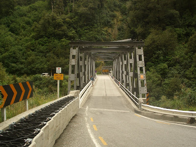
As we continued, the road climbed up to 3,000' and the tree line, and the scenery became quite alpine indeed. The road reached this enormous rock ampitheater and headed right for the wall, pierced by one small hole, the Homer Tunnel. It was started in the Depression as a work project, interrupted by WWII, and finished in 1953. To keep costs down, it was built single lane, with a traffic light to control the 1.2 km ride through in alternating 15-minute waves. That's our rental car first up, waiting for the green light.


Once through you descend those 3,000' to sea level very quickly, following the Cleddau River. At the bottom was the Milford Wanderer waiting for us,

and this view of the head of Milford Sound and the Cleddau Valley running off to the right. Ahead lay a second view westward to cloud-tipped Mitre Peak, rising 1682m (over 5,000') from sea level itself.


The map shows Milford Sound, which we explored by boat from the end of the road out to the mouth of the Sound, about 14 miles each way.

There were numerous waterfalls of staggering height -- two of these are about 500' each, hard to capture a sense of without a 50-story building nearby to give scale.


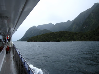
The boat had a lot of decks and the weather stayed dry for most though not all of the 2 1/2 hour voyage. Nonetheless, that's considered very good luck for Fiordland, since it rains about 70% of the time, with an annual rainfall of 4 to 7 meters, depending on where you are.


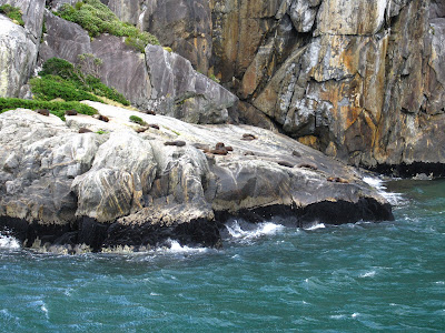
Besides many seabirds, we also saw fur seals basking in two places on opposite sides of the Sound.
We also saw constant examples of a phenomenon we had never heard of before, "tree avalanches." The ground is very rocky with a thin covering of soil.

When trees get large and the ground gets wet enough -- which it obviously does a lot in these parts -- a tree high up may start to topple over. The roots are so shallow and intertwined, however, that the one tree will pull up its neighbors, and soon the whole hillside is tumbling down into the Sound. The close-up scar on one of these pictures was the site of a tree avalanche maybe two or three decades ago, while the distant one with bare rock occurred four weeks before our visit.

It will be covered in mosses and lichens in the coming few years, then with small plants, larger plants, and finally trees by the time our grandchildren are old folks.

The land shoots almost vertically out of the water here, and one crazy lady some years ago actually sky-dived off this cliff and managed to pull the parachute cord in time to tell the tale. We'll close out on Milford Sound with one more photo of this spectacular place.


We drove from Milford Sound back out to civilization in the form of Te Anau, 120 km away, and on to the nearby town of Manapouri, on Manapouri Lake. Yes, another freshwater fiord, even deeper than Lake Te Anau, and fairly moody the next morning when we took the boat across. It rained all day, but fairly lightly for the most part and with occasional pauses, so it was far from unpleasant, though it was fairly cool, high 50's F.

After a 45-minute cruise across the lake, we hopped off the boat and onto a bus for a 22 km drive over 2,100' high Wilmot Pass and the descent to Doubtful Sound. The first glimpse of Doubtful foretold another interesting day.


This is a much bigger fiord than Milford, about 25 miles from the sea to the head of the fiord. As the map shows, it also has numerous arms extending a few miles each from the main channel. 
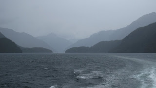
In our three-hour cruise on a faster boat than the day before we reached the mouth of the Sound and explored about half of narrow Crooked Arm, seen here, with many tree avalanche sites visible there as well.


In our three-hour cruise on a faster boat than the day before we reached the mouth of the Sound and explored about half of narrow Crooked Arm, seen here, with many tree avalanche sites visible there as well.


We also passed an island with a "hotel" for fishermen. You're seeing the entire establishment, right there!
They pull in for a break from the weather on the Tasman but this is a National Park, so on the way in and out they can only admire the scenery like the rest of us tourists. And what scenery it is! We also saw another seal hangout,

and had a brief encounter with some bottlenose dolphins. They were not into showing off this particular day, so all we saw were a few fins breaking the surface a hundred meters away.
One of the great things about a visit to Doubtful Sound is the peace and solitude. In Crooked Arm the captain turned off the motor and generator for about 2 minutes, and we enjoyed hearing the waterfalls all around and the birds. Unlike Milford Sound, we also saw virtually no other boats, 
until we encountered this school group getting a wet start to some sort of adventure from the hostel that sits at the head of the Sound just for such trips, mainly by middle schoolers.

until we encountered this school group getting a wet start to some sort of adventure from the hostel that sits at the head of the Sound just for such trips, mainly by middle schoolers.

We explained that only two of the fiords are easily accessible. Milford of course is by the road built mostly in the 1930's. Access to Doubtful Sound would still be by a three-day hike over the Southern Alps but for a hydro scheme that came to fruition in the 1960s. The original plan was to raise Lake Manapouri to enhance the power-generating, but that generated its own force field of environmentalist objection, and the episode is widely seen as the beginning of the environmental movement in New Zealand. An aroused electorate threw out the party in power and the incoming government ordered Lake Manapouri kept at its natural height.
What was done, however, was still monumental. A power station was built 750' underground, and water from Lake Manapouri that used to flow out to the southeast via a river is now channeled down to the generators and out a 10-km tunnel to Doubtful Sound, which sits 600' lower than Lake Manapouri. When you consider that most dams consider a 50' drop rather worthwhile, you can just imagine how much more power they get from this one!
What was done, however, was still monumental. A power station was built 750' underground, and water from Lake Manapouri that used to flow out to the southeast via a river is now channeled down to the generators and out a 10-km tunnel to Doubtful Sound, which sits 600' lower than Lake Manapouri. When you consider that most dams consider a 50' drop rather worthwhile, you can just imagine how much more power they get from this one!

But to build it, they needed material, and the easiest way to get it was over Wilmot Pass. They spent two years just constructing the road up and over the 2,100' pass, and when the hydro project was completed six years later the road was just sitting there, not really needed anymore. The government took it over, and now a handful of tour operators and private individuals willing to barge their cars and boat trailers over Lake Manapouri can access it as well. On the ride back we lucked out to get a seat behind the driver, and it's an exciting drive to be sure.

Back on the shores of Lake Manapouri, the bus drove over to a tunnel entrance, stepped out to get clearance from the hydro authorities, and the gates opened. We next drove down the 2 km-long tunnel, the curving yellow tube in the diagram,

descending those 750' to visit the "machine hall" where the generators crank out their megawatts. Now, this is a very thinly populated part of NZ. Where does this enormous amount of power go?

About 85% is earmarked for an aluminum smelter, largest in the southern hemisphere, that is located at the port of Bluff some 175 km away.
So, thanks to the hydro people for building that road, and to the environmentalists for keeping them in line so that Lake Manapouri is the jewel it is today. We're now headed to the east coast of the South Island to visit Dunedin and Christchurch, among other places. Write to you next from there!


